 Priority areas for contruction mitigation interventions
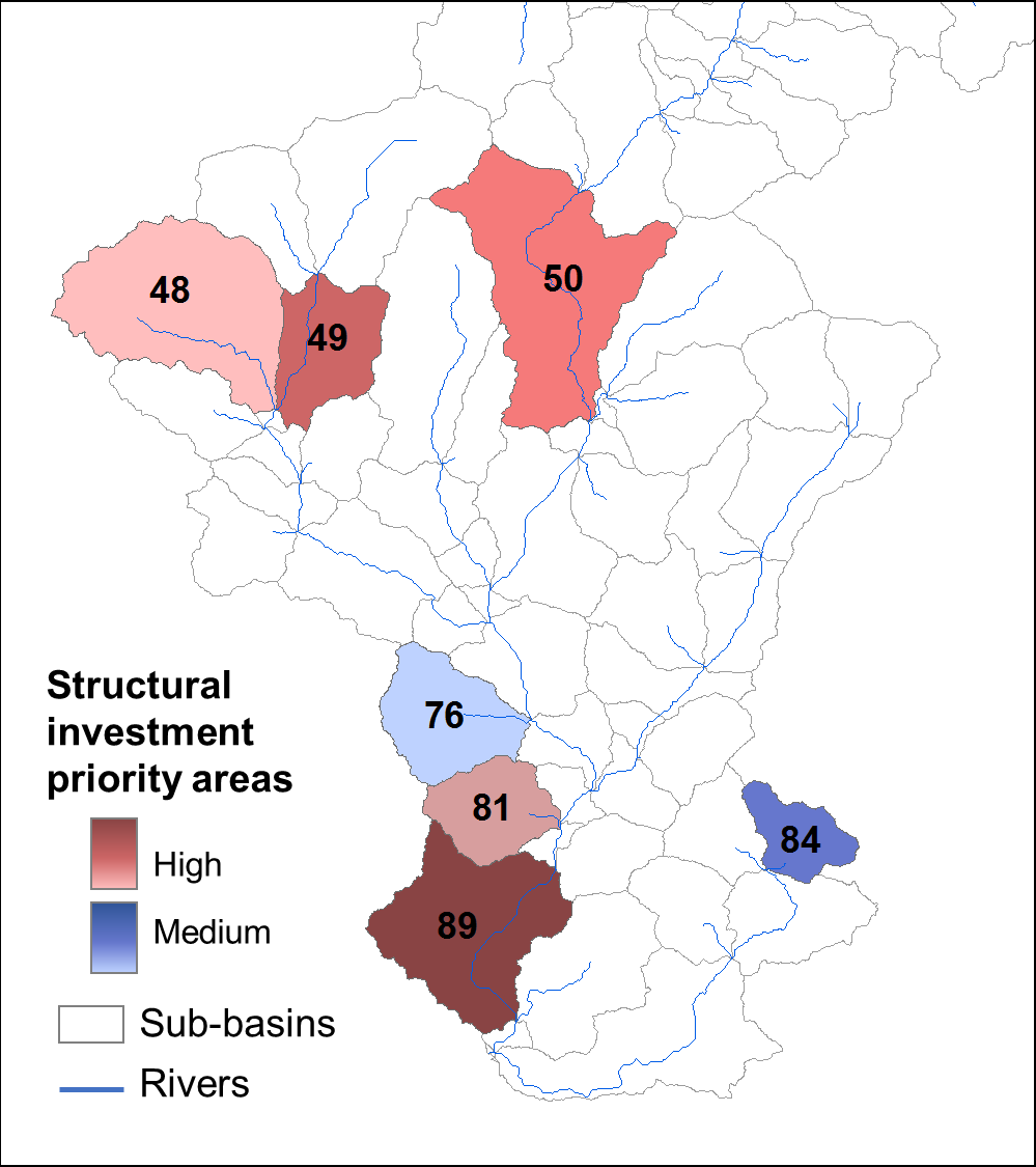
The study calculated the difference in sediment export between the baseline, mitigated, and unmitigated road scenarios in order to highlight areas where erosion is expected to increase the most between the unmitigated and mitigated scenarios. These sub-basins are most vulnerable to impacts from unmitigated road construction, based on their topography, soils, and land management characteristics. These areas tend to be those that have both the steepest slopes, the most erodible soils, and the lowest vegetation cover (e.g., barren land, sand, and certain types of crops such as maize).
Priority areas for contruction mitigation interventions