Introduction
Global Circulation Model (GCM) is a model that simulates general circulation of planetary atmosphere or oceans.
The term general circulation is used to indicate large-scale atmospheric or oceanic motions with its persistent
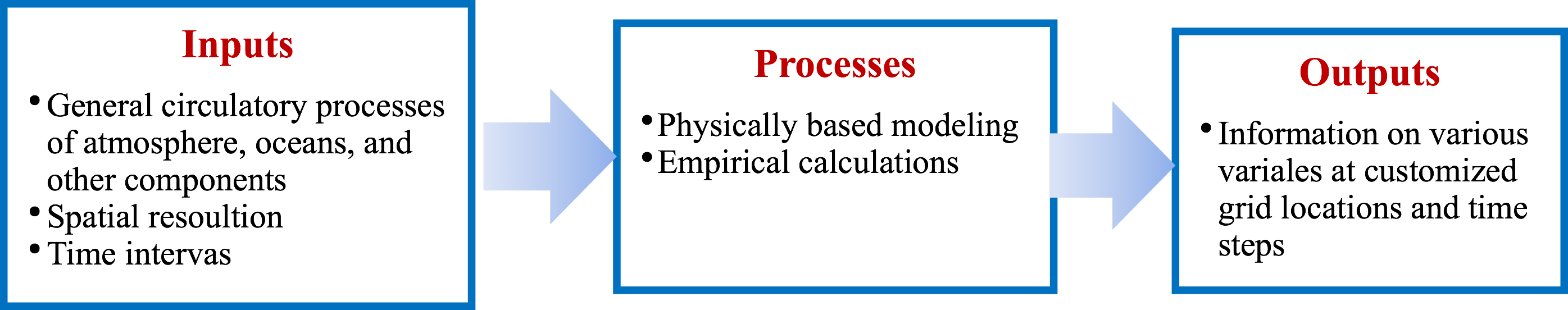
as well as transient features on various scales. GCM employs a combination of mathematical expressions that
represent governing physics of circulations processes and empirical calculations which replicate processes based
on data. Circulation related processes for planetary atmosphere or ocean are complex and interdisciplinary,
therefore, modeling of these processes involves many assumptions as it is difficult to represent all processes
in the model, huge number of calculations because of number of processes to be modeled, and uncertainty due to
lack of complete knowledge of all processes. GCMs that model planetary atmospheric processes are known as
atmospheric GCMs, and similarly oceanic GCMS and land surface GCMs are known for modeling of oceanic and land
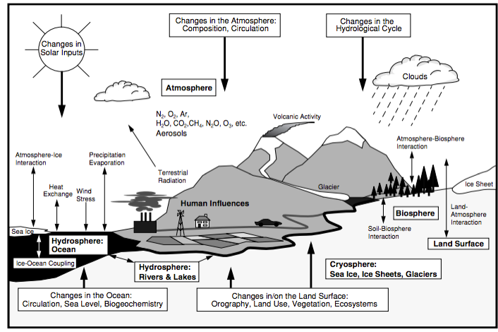
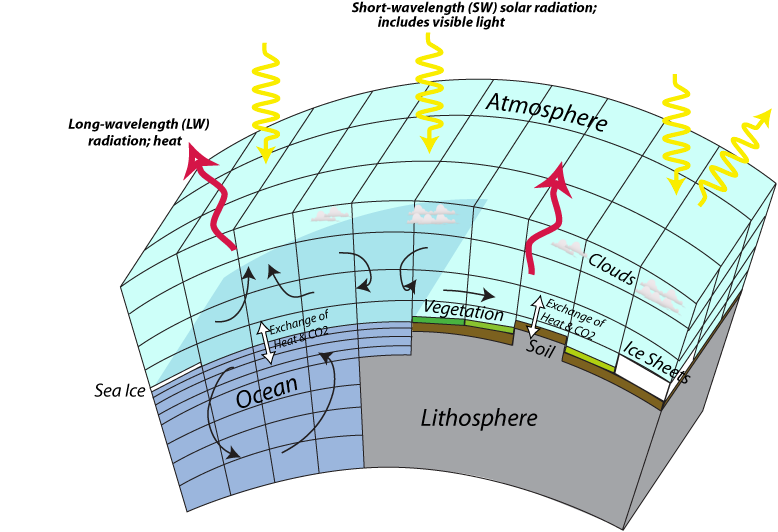
surface processes, respectively. Earth’s climate is driven by interactions between processes of atmosphere,
oceans, and several other components such as biosphere, hydrosphere, and cryosphere. Therefore, modeling of a
climate system requires coupling of various GCMs including components to model sea ice and other key planetary
processes. Coupled GCMs referred as Global Climate Models, which also have similar abbreviation as Global
Circulation Models, i.e., GCM.
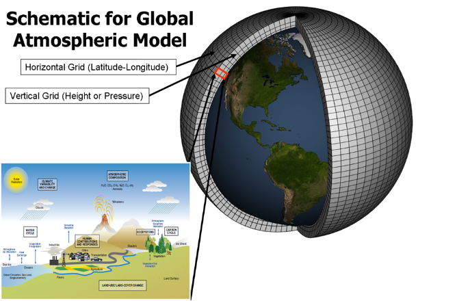
GCM’s spatial resolution varies from 100km to 500 km, and consists of significant number of vertical layers to
represent atmosphere as well as oceans. Number of factors including spatial- and temporal- resolution and level
of representation of processes play a key role in GCM’s ability to represent entire planetary system and
consequently model’s accuracy and its performance in various aspects. GCMs, by design, estimates numerous
variables, for example, surface radiation, humidity, temperature, and precipitation at original spatial and
temporal resolutions, and application of post-processing techniques, which popularly known as downscaling
techniques, allow estimation of variables at customized spatial scales and time step intervals.
GCMs have many applications including understanding, simulating, and predicting earth’s climate system. A
well-known application is to understand changes in earth’s climate system over lengthy time periods for future
plausible scenarios which are either due to natural changes in various components of earth system or increase in
greenhouse gas emissions that are chiefly responsible for global warming or combination of both. As part of the
Coupled Model Intercomparison Project (CMIP), major climate modeling groups worldwide ran conventional
atmospheric ocean global climate models (AOGCMs) and earth system models, and produced future climate
projections for twenty-first century and beyond. Ensemble of GCMs that constitute phase 3 and phase 5 of the
CMIP are known as CMIP3 and CMIP5, respectively. Relative to CMIP3 data, CMIP5 data derived from more number of
GCMs and that are more advanced. In addition, both datasets differ in how they define emission scenarios, which
reflects future emissions and consequent wide variety of effects. Therefore, direct comparison between two
datasets is not possible, however, similarities among a few scenarios allow comparison of model outputs from
CMIP3 and CMIP5. Analysis of model outputs assists in understanding climate variability and climate change.
CMIP3 and CMIP5 model outputs provided input for the Intergovernmental Panel on Climate Change (IPCC) Fourth
Assessment Report (AR4) and Fifth Assessment Report (FA5), respectively.