Hazard United States – Multi-Hazard (HAZUS-MH)

Purpose: Flood risk analysis
Developer: United States Federal Emergency Management Agency (US FEMA)
Key Features: Spatial location of water quality hotspot
Latest Release: 2015, Version 3.0
OS Platform: Windows
Cost: "Free" Requires: ArcGIS and Spatial Analyst for Flood Model
Related Software: "HEC-FIA, FLEMO"
Website: HAZUS-MH home page

Introduction

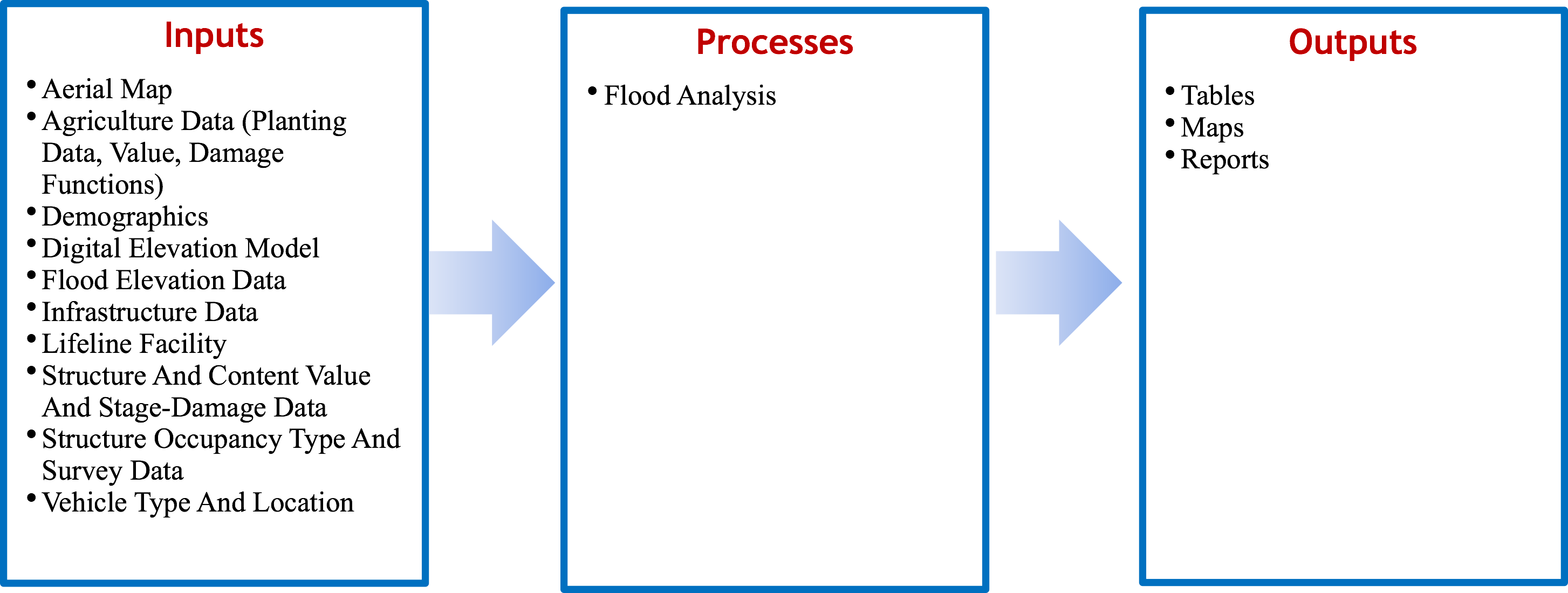
HAZUS-MH (Hazard United States – Multi Hazard), first released in 1997, uses a standardized methodology to estimate physical, economic and social impacts of disasters from earthquakes, floods, hurricanes and high winds. Specifically, HAZUS-MH estimates impacts by overlaying the spatial locations of potential hazards with structures, population, vehicles, utilities, etc., in ArcGIS. HAZUS-MH, as part of its vulnerability assessment, creates relationships using hydrology, hydraulic, and economic data to create relationships between annual exceedance probability and peak discharge, discharge and stage, and stage and damage. The program has been applied in flood mitigation, policy- making, planning or zoning, emergency planning and response, and to estimate sectoral economic impacts. The key feature of the HAZUS-MH software is an extension to ArcGIS that allows for pre-processing and visualization of outputs. HAZUS allows for three levels of analysis (basic to advanced) depending on data availability.

Advantages and Limitations

Advantages Limitations
  • Compare and analyze various alternatives
  • Calculate economic and societal impacts
  • Calculate hurricane, earthquake, and wind damages
  • Developed technical and user manual
  • Proof of concept demonstrates international use
  • Estimate debris volume
  • Technical support provided virtually or via an in- person training class
  • Determines if lifeline facility will be impacted
  • Determines flooding impact from coastal or riverine systems or both
  • Hydraulic analysis within model is based on Manning’s Equation; doesn’t account for backwater effect
  • Program data and maps developed for US; international maps and databases will have to be developed
  • Inability to estimate loss of life
  • Requires broad range of disciplines
  • No accounting for uncertainty
  • Not applicable for flash floods

Illustrative Screens

Sample Applications

Africa East Asia and the Pacific Europe & Central Asia Latin America & the Caribbean Middle East and North Africa South Asia

World Bank - All rights reserved.