Introduction
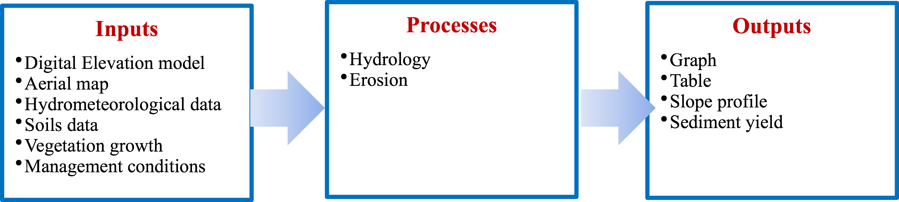
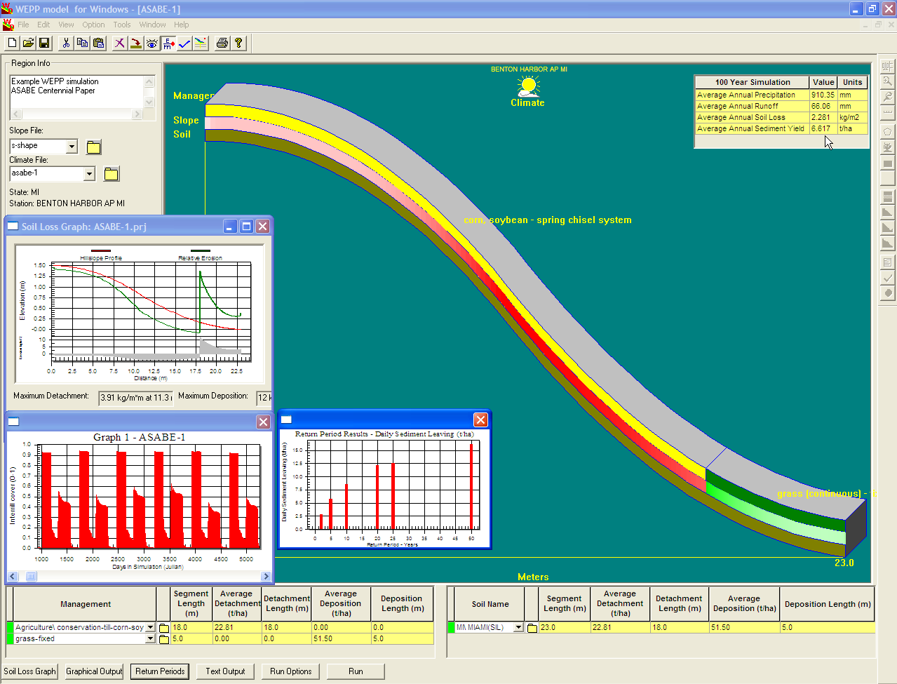
The WEPP erosion model, first released in 1995, is a process-based, distributed parameter, continuous
simulation, erosion prediction model that computes soil loss along a slope and sediment yield at the end of the
hillslope for small watersheds. The WEPP models erosion as mix of the different erosion processes (rill and
inter rill) occurring in the study area. After the peak runoff rate and runoff duration have been estimated from
overland flow routing, steady state conditions are assumed and the peak runoff rate is used for erosion
calculations. Erosion equations are then normalized for peak flow and shear stress at the end of the uniform
slope. The model has been used to estimate the amount of erosion from farmlands or hill slopes for small
watersheds, and results can inform soil and water conservation management options for agricultural, rangeland
and forest areas
Key features of the WEPP model include its use of physics-based formulas, and the estimation of the amount of
erosion. The model also benefits from an ArcGIS extension (GeoWEPP) developed by the University of Buffalo.