MODLFOW

Purpose: 3-D ground water modeling
Developer: United States Geological Survey (USGS)
Key Features: Modular structure; Open-source; A set of software utilities for model calibration, pre- and post- processing, and GUI; 1-, 2- and 3-D calculations
Latest Release: Version 1.11.00, August 2013
OS Platform: Windows, UNIX
Cost: Free
Related Software: FEFLOW, Visual MODFLOW, Aquaveo GMS, PMWIN
Website: MODFLOW information

Introduction

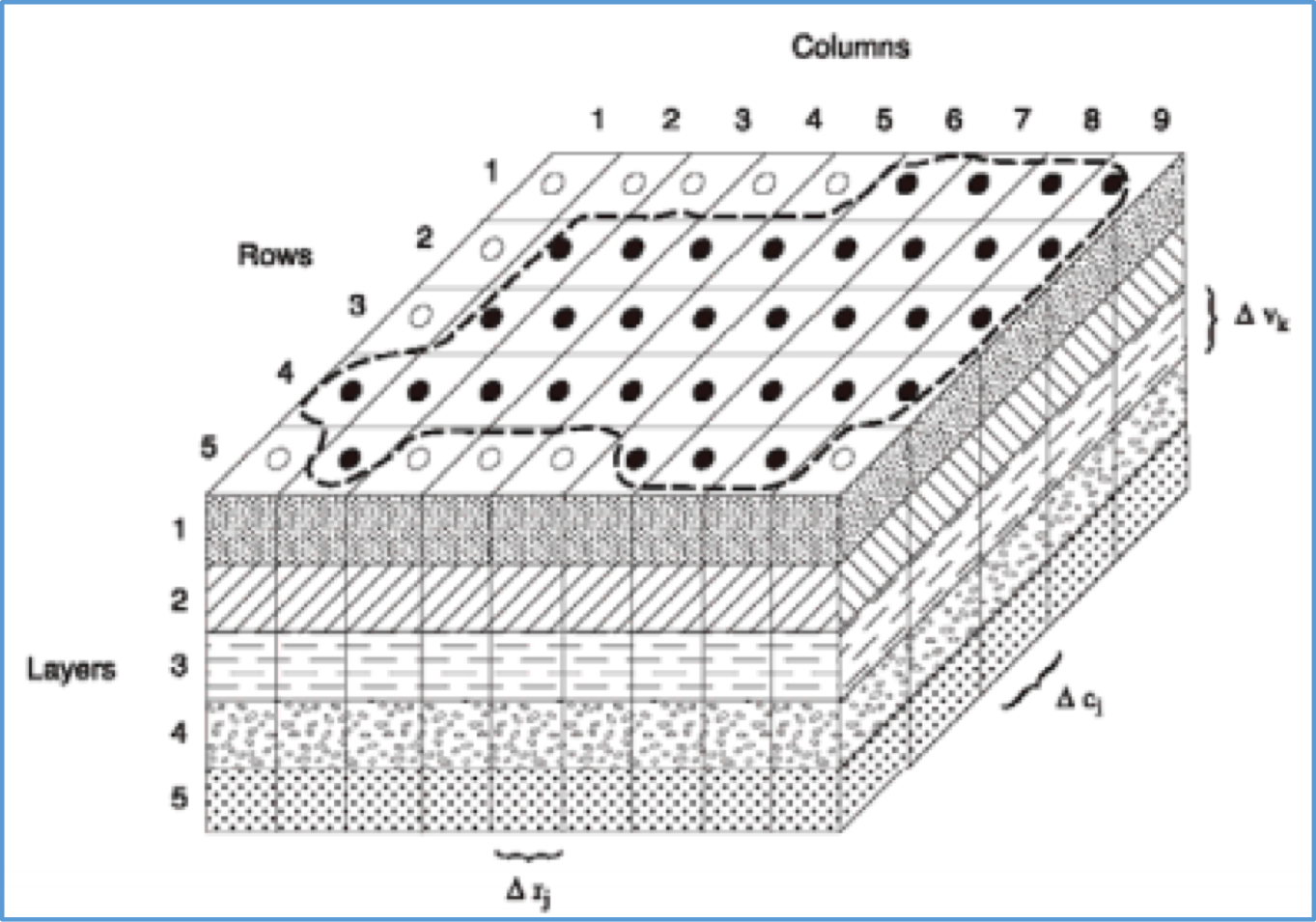
The MODFLOW model simulates groundwater flows in aquifers. The model partitions aquifer systems into grids of cells, and models hydrologic and hydraulic processes for each grid cell, as well as interactions between different grid cells. Certain processes, such as the recharge process, are modeled as interactions between the aquifer system layers and water bodies such as reservoirs and lakes. Using Darcy’s Law equation, MODFLOW calculates the water budget for each grid cell, yielding simulated flows that are in either steady or transient state. MODFLOW has been used to simulate and predict ground water conditions and coupled groundwater/surface water interactions. Additional modules have incorporated solute transport, variable-density flow (including salt water), aquifer-system compaction and land subsidence, and groundwater management. The tool performs 1D, 2D and 3D calculations.

MODFLOW lacks a Graphical User Interface (GUI), but has a set of software utilities for model calibration and sensitivity analysis, pre- and post-processing of data and GUI. The software’s modular structure allows the user to customize a set of modules, usable for various applications, including integration with other software tools.

Advantages and Limitations

Advantages Limitations
  • Modular structure allows integration of other tools to enhance ground water modeling, and the ability to create variants of MODFLOW for various applications
  • Freely available software utilities for model calibration, pre- and post- processing and GUI
  • Widely used world-wide resulting in a variety of case studies
  • Detailed technical report and users' manual
  • Freely and commercially available software utilities for model calibration and GUI for pre-processing and post-processing
  • Support from third party vendors
  • Unsaturated aquifers cannot be modeled
  • Absence of inbuilt GUI
  • Cannot simulate multiphase flow

Illustrative Screens

Sample Applications

Africa East Asia and the Pacific Europe & Central Asia Latin America & the Caribbean Middle East and North Africa South Asia
Regional groundwater modeling, Benin Environmental assessment study, Brazil Environmental assessment study, Gaza Groundwater flow modeling in the Bengal basin, Bangladesh

World Bank - All rights reserved.