Introduction
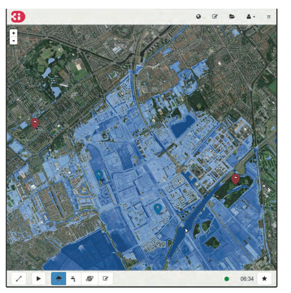
3Di is a dynamic water model that simulates flooding in urban, river and estuary environments. The program
models flow in 1D and 2D using the Saint Venant equation. Groundwater flow is estimated using Darcy’s law
equation. 3Di is useful for disaster risk management, as it can evaluate various flood management decisions such
as raising dikes and potential closures. 3Di can also be used to evaluate dike breaches, for 2D modeling of
rivers and estuaries, and in spatial flood planning and the design of urban flood drainage systems.
Key features of the 3Di model include cloud computing, which allows the model to have 1 billion cells,
visualization tools, and the ability to process geospatial data.