Introduction
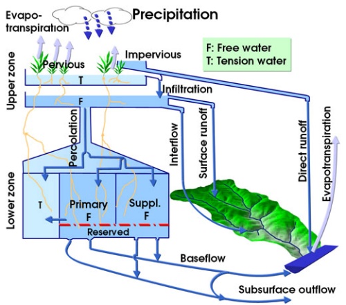
The SAC-SMA is a continuous soil moisture accounting model with spatially lumped parameters that simulates
runoff within a basin. The model divides the basin into lower and upper zones at different depths, and defines
the distribution of moisture, i.e., tension water components (driven by evapotranspiration and diffusion) and
free water components (driven by gravitational forces) in each of these two zones via a set of parameters. The
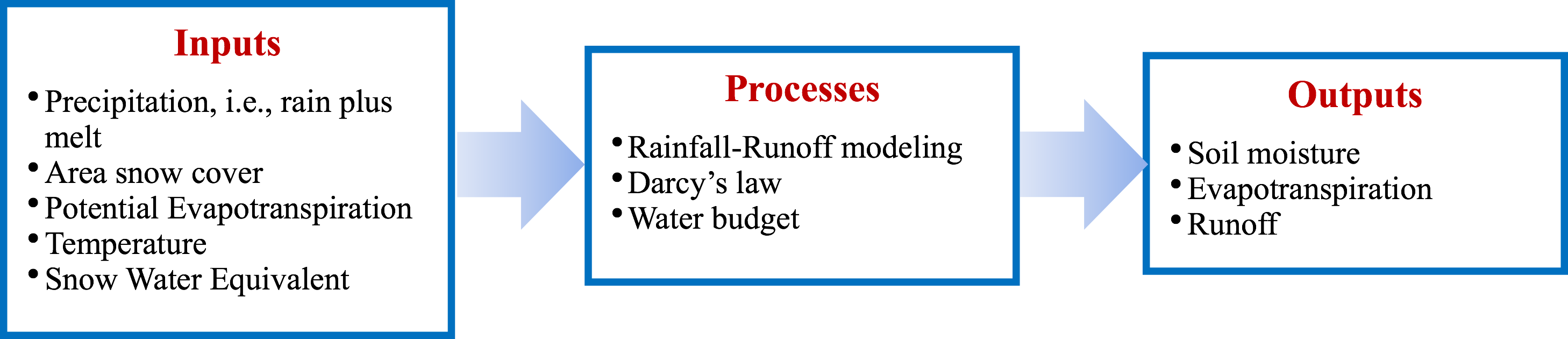
model uses precipitation and temperature variables, along with parameters on soil moisture states and the
basin’s relative permeability to estimate the amount of water that enters, is stored in, and leaves the basin.
Thus, the model estimates several key hydrologic processes including evapotranspiration, percolation, interflow,
and different forms of runoff from a basin. The SAC-SMA also has a modeling component to model effects of frozen
ground on the rainfall-runoff process. The SAC-SMA model is used for various applications that are mainly
streamflow or runoff centric, for example, river forecasting, water supply forecasting, basin hydrologic hazard
estimates, and basin climate change assessments. The model is ideal for large drainage basins and uses multiple
years of records for calibration. The SAC-SMA model is a key model used by the U.S. National Weather Service
River Forecast System (NWSRFS) to issue river forecasts across the country. The model code (written in Fortran)
is publicly accessible.