Introduction
MIKE HYDRO, formerly known as MIKE BASIN, is an integrated water resources management program that incorporates
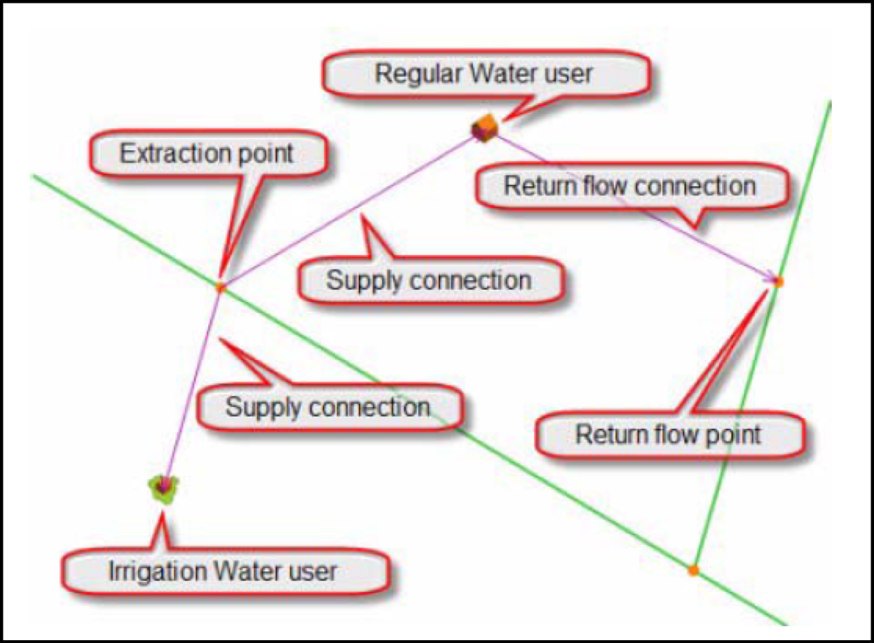
allocation, management, and planning of water resources at a river basin scale. MIKE HYDRO is a network model
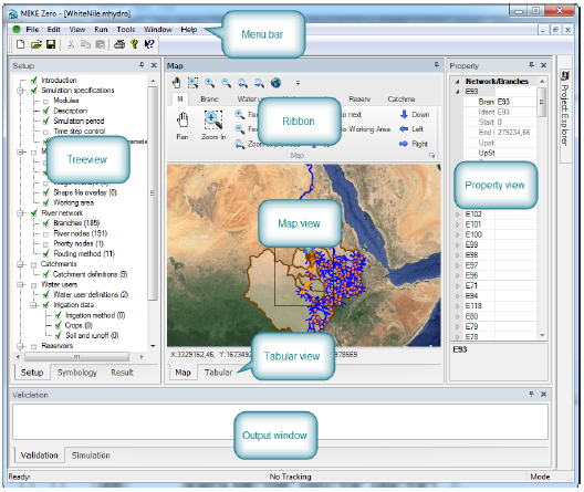
that represents rivers and tributaries by a network of branches and nodes. The program consists of two modules:
a basin module and a river module. The basin module allows the user to allocate, manage, and analyze water
resources at a basin scale. The river module, a subset of MIKE 11, is a 1D river hydraulics model. MIKE HYDRO
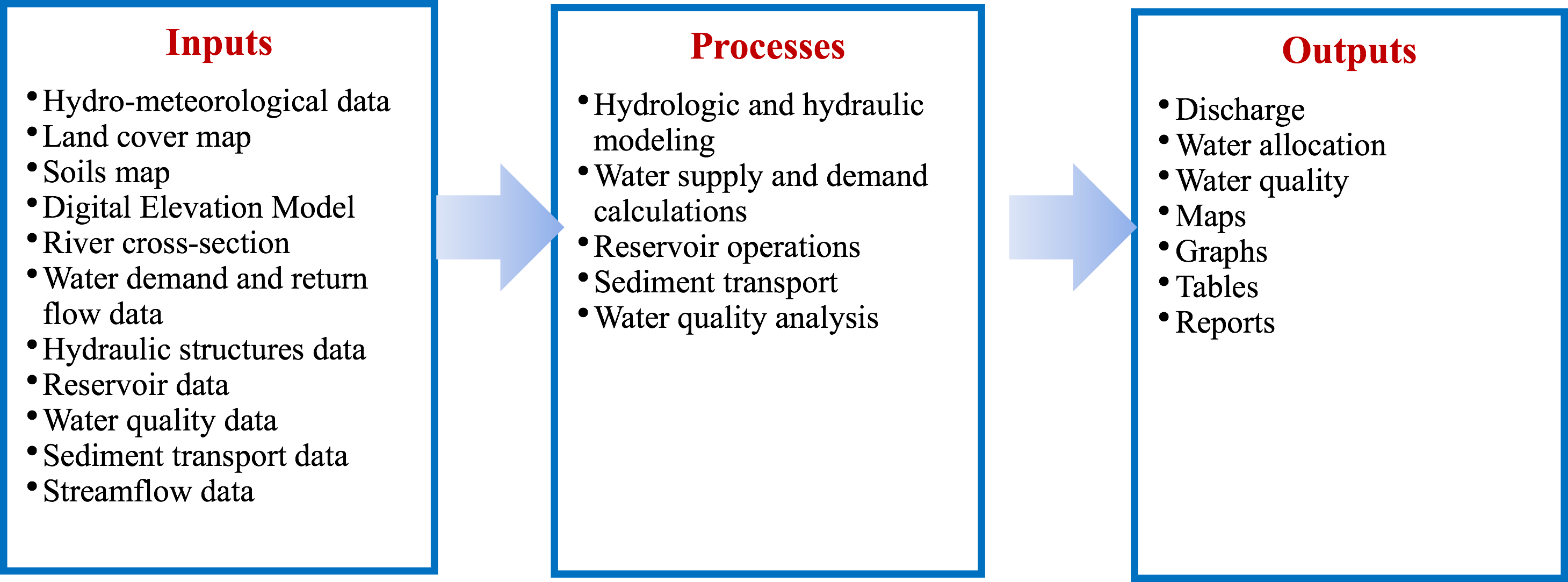
has been used for reservoir optimization, sediment transport, water quality, and streamflow forecasting.
Key features of the MIKE HYDRO model include GIS integration, rainfall-runoff modeling, ranking of water users,
and scripting.