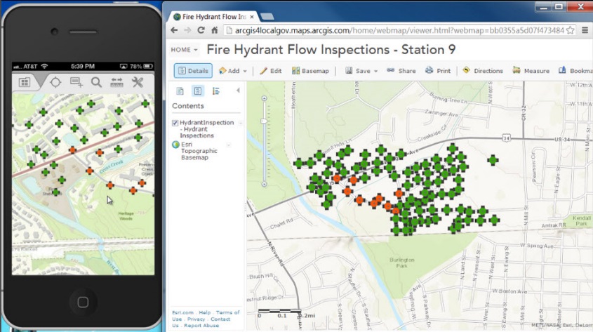
Description: ArcGIS Collector extends the ArcGIS platform to the field by allowing the user to create
and share maps using ArcGIS and then collect data to add to the maps, including point, line and area features
and images and videos, using mobile devices (smartphones or tablets). ArcGIS Collector can work offline and
users may sync work when a connection is available. The software also features predefined industry templates
with which to collect data. Data moves seamlessly from the mobile device to the tablet (ArcPAD) and to the
desktop (ArcGIS), and editor tracking shows when features in a shared map were last edited and by whom. To use
maps in Collector, user must have an ArcGIS organizational account. Maps can include data from ArcGIS Online,
Portal for ArcGIS, and ArcGIS for Server. Currently in development for ArcGIS Collector is support for
external GNSS receivers, support for Windows 10 Mobile, and integration with Navigator for ArcGIS. In the
future ESRI is planning smarter data collection forms, more tools for planning offline field operations, data
collection with offsets, and integration of peripherals (laser range finders, bar code scanners, etc…)