Michigan – ICT tools and applications for forest inventory
I. Forest area and ownership
Michigan State in USA has 36 million acres of land, of which 19.70 million acres are forested, which makes Michigan one of the most forested states in the country. About 60 percent (11.8 million acres) of Michigan’s forests are privately owned by nonindustrial landowners, corporate owners such as Real Estate Investment Trusts (REITs), Timberland Investment Management Organizations (TIMOs), forest industries, and others. The remaining 40 percent (7.9 million acres) is held in public ownership (state, federal, and municipal). (More information on Michigan forests could be obtained from http://www.michigan.gov/dnr/0,4570,7-153-10370_22664-61596--,00.html)
Michigan forest is one of the largest state forest systems in the United States and contains watersheds of the largest system of fresh surface water on earth. Since the 1980 inventory, the estimate of forest land has increased by nearly 2 million acres accompanying this increase, the total number of trees, volume, and biomass also have risen. Reforestation is a vital part of the forest department’s mission. An average of 6 million seedlings are planted on about 6,000 acres of state forest land each year. These seedlings are produced in the Department of Natural Resource’s (DNR) Wyman Nursery and include 1 to 2 million seedlings planted annually for habitat to support the federally endangered Kirtland’s warbler. (Source: Forests of Michigan 2014 "http://www.fs.fed.us/nrs/pubs/ru/ru_fs35.pdf
Michigan’s state forest system is unique because it is dually certified with both the Forest Stewardship Council (FSC) and the Sustainable Forestry Initiative (SFI) programs. This rigorous, two-party certification helps ensure retention of forest-based jobs and forest sustainability through an independent, third-party review of environmental, social and economic benefits of forestry practices.

II. Uses of the forest
Michigan’s forests provide numerous ecological functions including water, soil and air quality protection, biodiversity, carbon sequestration, and fisheries and wildlife habitat. They offer recreational opportunities, landscape diversity, and cultural and spiritual experiences. Forests also support viable, stable rural and urban communities, and supply society with forest based products and services. About 8 million acres of forest land are available to hunt, fish, explore, hike, bike and enjoy and 2 million acres of private forest land are open to hunting and fishing under the DNR-administered Commercial Forest program, and the 60,000-acre Porcupine Mountains Wildness State Park (aka "the Porkies"). Click on the interactive map in your area of interest to learn more about state forest activities: http://www.michigan.gov/dnr/0,4570,7-153-30301_68515---,00.html and Online Services such as Burn Permits-Apply Here, DNR Social Media Services Digital DNR Michigan E-store DNR Email could be accessed from Digital DNR, Michigan E-store, http://www.michigan.gov/dnr/0,4570,7-153-10366_34947---,00.html"
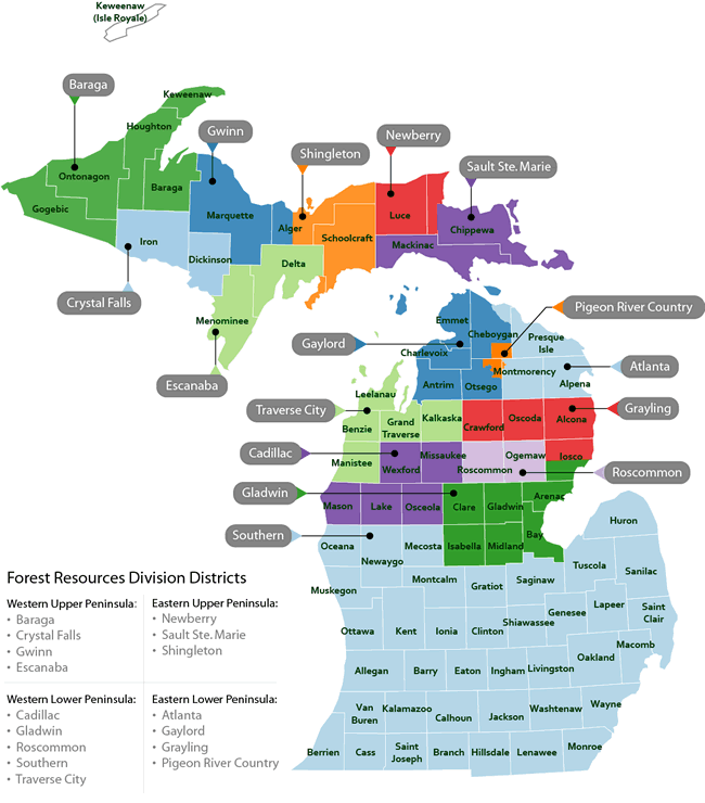
III. Management
The Forest Resources Division (FRD) of the Michigan Department of Natural Resources (DNR) is responsible for the management of the 4 million-acre state forest to support economic, environmental and recreational needs of Michigan residents and businesses. Professional, sustainable management of the state’s forests provides the leadership, expertise and blueprint for the larger statewide forest resource and is a catalyst for the forest products industry which generates $14 billion annually and sustains 154,000 jobs. Part of this management plan includes the annual inventory of 10% (400,000 acres) of the state forest each year. This is part of a strategic, continuous 10-year cycle to complete a comprehensive review of the entire state forest system. This review cycle helps resource managers propose treatments to keep forests healthy and commercially viable for timber harvesting and recreational purposes.
IV. Use of ICT tools and applications for sustainable forestry development
A. The Problem:
Prior to 2014, the forest inventory process in Michigan was labor and paper intensive which took 40% of a state forester’s time over a 12-month period. The staff recorded the data on paper and then the staff had to drive back to a field office to enter the data into a stand-alone legacy application. There are 80 state forester employees operating in remote field offices across the State of Michigan whose duties went beyond carrying out inventory of forest land.
B. The Solution
In 2014, the State of Michigan launched the Michigan Forest Inventory system (MiFI). The Forest Department (DNR) asked DTMB to help automate the inventory process of the forests so that state foresters could reduce the 40% of their time to 20% - with the remaining 20% to pursue other important tasks. The secondary goal was to build upon a data management platform that captured the forest assets in a central data repository, complimented with geospatial assets that could be leveraged across state government. This new system transformed a paper-based inventory process into a fully automated, mobile enabled solution that allows state foresters to complete all field work with a portable lap-top device and software that uses attribute data for every acre in the state forest.
C. The Process
The Forest Resources Division (FRD) spent several months in 2013 working alongside representatives from industry, and state, federal and local governments, and conservation groups to develop a 5-year strategic plan (2014-18) https://www.michigan.gov/documents/dnr/FRD_Strategic_Plan_513006_7.pdf to guide the decisions and actions governing the health of Michigan’s state forest resources.
The process began with the assessment of the current status, roles, functions, and accomplishments and failures of the forest resources division. This was necessary since the development of sustainable, professional forest stewardship required the FRD to be dynamic, efficient and responsive with a clear picture of the role and purpose it would serve. FRD invited a broad group of employees to serve on the strategic planning team and utilized staff and stakeholder surveys, outreach and public involvement with the help of a facilitator and strategic planning expert, Colonel (ret) Berri K. Meyers, who worked with the FRD to develop the mission, vision, values, goals and objectives to plan the course of this division for the next three to five years. The strategic planning process guided the department to define more clearly the department’s functions, what was done well and identify areas needing improvement to better serve the broad and diverse interests of the many customers and to better manage and protect Michigan’s forest resources. This strategic plan was the result of many facilitator-led meetings that gave a strong starting point for development and change.
D. Objective
One of the main objective of the strategic plan was: “Embrace cutting-edge technology to enhance the effectiveness and efficiency of work on timber sales, forest inventory, the Commercial Forest Program and burn permits. Aging technology must be updated in order to yield the benefits of technological advancements and improve efficiency”.
E. From objective to action:
The above objective was transformed into a technology project. DNR and the Department of Technology, Management and Budget (DTMB) examined the current “as-is” process for collecting forest information, identified redundancies and practices better suited to automation. After completion of an 8-week workshop, the joint team made recommendations for:
- Retiring stand-alone collection systems and
- Developing a single point collection system that could be used with mobile technology in the field by state foresters to collect information that could complement the stated strategic outcomes identified in the plan.
F. The MFIF application:
- uses base data and lets foresters add data attributes that had previously been stored separately (tree stands, treatments, site conditions and roads); and
- complimented a broader strategic vision of consolidating data assets in one place which would assist in providing more open data sets to the public via the open data portal. The state’s Executive Directive 2013-1 Data and Information Sharing, Management and Governance (http://www.michigan.gov/documents/snyder/ED_2013-1_439597_7.pdf) mandated more open data and better data sharing between state agencies; and complimented a broader strategic vision of consolidating data assets in one place which would assist in providing more open data sets to the public via the open data portal. The state’s Executive Directive 2013-1 Data and Information Sharing, Management and Governance (http://www.michigan.gov/documents/snyder/ED_2013-1_439597_7.pdf)
G. Project Scope:
The scope of the MiFI project was to create a technology solution to assist the FRD staff in completing inventory assignments more quickly and efficiently for 400,000 acres of forest land each year. This scope:- Addressed the need for collecting better data attributes about the forest, and
- Leveraged GIS technology to add new data layers, with each layer adding new information about the forest (tree type, forest location, roads and trails, topography, vegetation, minerals etc.).
H. Distinctive features:
The MiFI project is distinctive from similar projects focused on data collection. They are:- The project supported data collection by foresters in the field using 100% mobile technology - from the Tough-pads used to enter the data, to the GIS tools used to collect data attributes. This data is then used across the DNR by land managers to improve decision making concerning the natural resources of the land;
- Innovative ways of engaging customers in requirements gathering, by using an agile process to define and execute requirements at a faster pace. Rather than meeting in conference rooms, the requirements gathering meetings occurred in rather rustic cabins located near large forest areas that housed our end users (FRD staff). The requirements (product back-log) were captured and tracked in Microsoft Team Foundation server (TFS) using the “scrum board” feature. This same platform was used to store code and ensure version control;
- FRD staff head into the woods and “click” on the MiFI application icon from their Tough Pad. Based on their location, they “check-out” forest inventory attribution records which include GIS maps with Geospatial data attributes;
- Using ArcGIS, a technology solution developed by ESRI, staff can redraw forest boundaries, modify maps to include new roads, culverts etc. and calculate forest inventory (tree type, density, age), and calculate estimates of harvestable wood.
I. Management and Organization of the MIFI Project:
The project team consisted of a project manager, 3 business analysts from the DNR/FRD, and a part-time architect to help configure the SQL server 2008 with the ArcGIS server. Two developers (GIS and .Net C#) and a part-time quality assurance specialist helped manage software development and software versioning via Team Foundation Server. The MiFi project began in March 2014, and was launched in October 2014. The project was 100% in-sourced to state of Michigan staff. Communication and project awareness was efficient; FRD field staff were involved in both the design and testing. This complete engagement made the users willing to adopt the new technology with a minimum of resistance. A dedicated project manager was assigned and the state’s unified information technology project management protocol (SUITE) to track progress and secure customer agreement on acceptance criteria for each project deliverable was followed. Within the project development lifecycle stage exits are in place to ensure the application meets architectural, security and accessibility requirements.J. Project cost:
When the project was launched in October 2014, the total project cost was $475,000, consisting of $300, 000 in billable technology hours, $25,000 for software and server costs, $150,000 for new portable Tough-Pad devices for office and field work for 80 FRD staff.K. Source of funding:
the project was funded using restricted funds obtained via timber sale revenues.L. Monitoring project progress and impact:
The outcomes of this project are being tracked within the DNR’s public facing scorecard, (https://www.michigan.gov/documents/dnr/DNR-Scorecard_422577_7.pdf with measures for: (i) timber economy jobs, (ii) acres of state forests receiving active habitat management or maintenance, and (iii) State forest acres assessed for Emerald ash borer impacts. In addition, recognizing the importance of climate change, the US forest service’s northern research station and the northern institute of applied climate science have produced a climate change vulnerability assessment of Northern Michigan’s forests. "Michigan Forest Ecosystem Vulnerability Assessment and Synthesis” is available online at http://www.nrs.fs.fed.us/pubs/45688.M. Project Benefits
The project yielded multiple benefits to a diverse group of stakeholders, some of which are:- The Michigan forest and timber industry have been early benefactors. Timber is periodically offered for sale from Michigan state-managed forest land. Sales are conducted for the purposes of harvesting mature and over mature trees, responding to past or predicted insect and disease outbreaks, salvaging fire-damaged trees, enhancing wildlife habitat and improving health of forest trees;
-
Forest resources division :
- Helped the FRD staff with on-site, real-time forest inventory to develop timber sale forecasts and bid proposals 2 month’s sooner than pre-automation;
- Allows FRD to prepare timber bid specifications much faster for contractors authorized to bid on removing trees in designated areas;
- Helps the DNR to better forecast revenues from timber sales which are essential in preparing fiscal year spending plans and budget appropriation requests increased the economic contribution of forest products with faster time-to-market harvest bids and accurate inventory and location of harvestable tree stands.
-
Improved decision making,increased efficiency and performance of DNR staff through the use of ICT tools and
applications:
- The MiFI application, which combines mobile technology, state-of-the art tablets and geospatial data have made the foresters much more efficient in collecting and acting upon data associated with the maintenance of 4 million acres of state forest land. Separate applications for timber health, timber commercial specifications and forest infrastructure have been eliminated and consolidated into a single purpose data repository that manages all aspects of forest management. This tool has extended the reach and productivity of each of the 80 foresters and has returned additional time to their work schedule to help remedy issues discovered during these targeted site visits.
- Single source data system enables foresters make correlations which was not possible before, e.g. biologists and foresters can make initial recommendations for reducing the spread of emerald ash borer infection by using the data to recommend treatments including clear cutting, selective thinning, prescribed fires, tree planting, or no treatment at all.
- Made a permanent change within the DNR on the role mobile technology can have for their workers. From a technology standpoint, FRD retired 80 office-based PC’s and outfitted each FRD staff person with a state-of-the art Windows 10 rugged tablet (Tough-pad). This mobile solution allows for both field work and office work on one device.
- DNR staff can access MiFI using any browser and any device. Adhering to DTMB’s published technology roadmap, this native mobile application was developed using Apache Cordova to provide cross-platform capabilities (Windows, Android), with code developed in sustainable technologies that include AngularJS, JQuery Mobile and C# these technologies are aligned with the technology roadmap and ensure compatibility.
- DNR staff could electronically evaluate forest parcels, measuring forest density, wood type and age for commercial purposes; Record attributes about the health of the tree canopy and soil conditions (erosion).
- Biologists use the data to prescribe treatment options;
- Update data attributes for other conditions not associated with trees, such as forest roads, bridges, culverts and other forest infrastructure to assist in long-range infrastructure upgrades.
N. Sources and contact information :
(Source for the above content is from http://www.michigan.gov/dnr; http://www.nascio.org/portals/0/awards/nominations2016/2016/2016MI7-NASCIO%20-%20Forrest%20Inventory%20System%20(FINAL).pdfFor more information, please contact: Michigan Forest Inventory system (MiFI), Jim Hogan, (517-284-6006), hoganj@michigan.gov