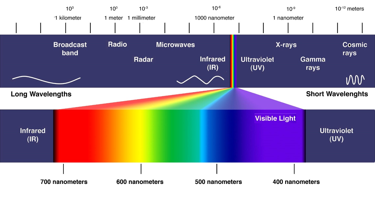
Remote Sensing (RS) involves the acquisition and processing of information about an object or phenomenon without making contact with the object. It is mainly used in Earth Science disciplines such as hydrology, ecology, oceanography, geology, forestry in order to analyze data over time and space for meaningful decision-making. Remote sensing technology captures the red, green and blue part of the electromagnetic spectrum, the part visible to the human eye.
☰ Open Tutorial
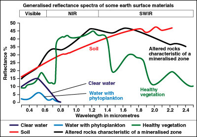
Space-based satellites capture data about the planet using sensors that measure visible, infrared, near infrared to radar / radio part of the spectrum. Various objects (soil, water, vegetation) have different reflectance patterns that are captured by satellites (raw data), adjusted for atmospheric effects and cloud cover, and then converted into images using classification methods. For example, wheat, rice and corn all have different reflectance patterns and once the classifications are applied to the raw data, the image will show the location of these crops. Satellites usually monitor the smaller spatial areas of each for shorter time intervals, or monitor most of the planet at longer intervals (a few days to a few weeks).
Complex applications of remote sensing data include LiDAR and radar datasets, which are used for monitoring flows or lake levels. [Need image]
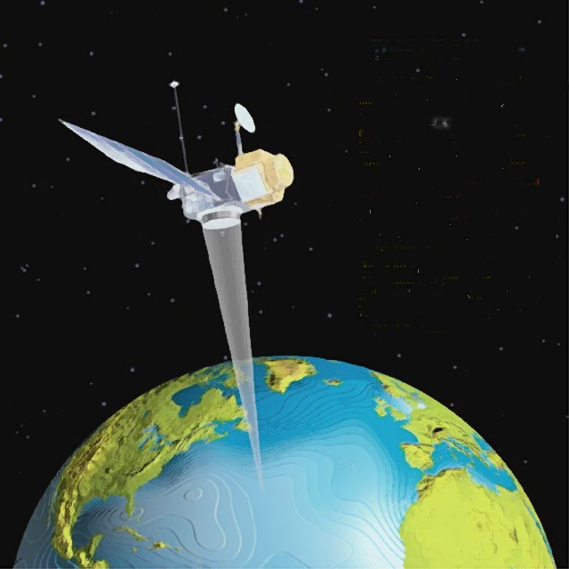
Many satellites have been launched over the past 50-60 years to capture and monitor earth data such as land cover, evapotranspiration, croplands, mineral wealth, deforestation and carbon stocks. Satellites have different resolutions (the coarseness or fineness of data) which change the quality of the image.
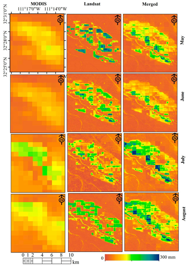
Images (here, cropland monitoring data using average evapotranspiration data) from the MODIS satellite (resolution of 250 m) are much coarser than those from the Landsat satellite (resolution of 30 m). MODIS data are collected more frequently then Landsat data, illustrating the tradeoff between the frequency of data collection (temporal resolution) and the spatial resolution.
World Bank - All rights reserved.