Carnegie Airborne Observatory
| Name/Title: | Carnegie Airborne Observatory |
| Source (Company/Organization): | Carnegie Institution of Science |
| Category | Remote Sensing Platform |
| Sector | ICT, Forestry, Agriculture, Biodiversity |
| Technology Platform | Data Collection Sensor |
| Date Started/Timeframe | 2005 - present |
| Website/URL | https://cao.carnegiescience.edu/ |
| Location(s) | Pasadena, California |
| Primary Language: | English |
| Keywords: | Data Collection, Remote Sensing, Mapping |
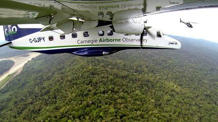
Carnegie Airborne Observatory mission mapping forests
Description:
The Carnegie Airborne Observatory has had three major monitoring systems throughout its History – CAO Alpha, CAO Beta and the latest instrument being AToMS (Airborne Taxonomic Mapping System) on board their plane. Previous instruments had Visible to Near Infrared Scanners, wLiDAR and LiDAR Scanners. These systems made major contributions to ecological studies in California, Panama, Peru, Colombia and South Africa.
AToMS has three integrated sensing technologies: (i) High Fidelity Visible-Shortwave Infrared (VSWIR) Imaging Spectrometer; (ii) Dual-laser, waveform Light Detection and Ranging (wLiDAR) Scanner, and (iii) High-resolution Visible-to-Near Infrared (VNIR) Imaging Spectrometer. AToMS is now in its third generation configuration, with advances in all sensors. It can map features on the Earth’s surface in three dimensions, including all terrestrial ecosystems and the human-built environment. AToMS can also image coral reefs and other aquatic habitats with spectral detail.
Using these hyperspectral data collected on board this platform, CAO researchers have mapped various species, land and soils in rainforests using chemical variations, carbon stocks in Peru, archaeologic sites in Central America, very high resolution terrain details in forests, changes in forests in steep terrains in Amazon and more.
How can the ICT product/innovation benefit the project?
The level of detail in terms of spatial resolution (few centimeters) and spectral resolution (LiDAR and hyperspectral data in VSWIR and VNIR) allows for detailed mapping such as highly accurate stock estimates, distinguishing between species etc. which are not possible through traditional satellite imagery products. This could better the understanding of ecology, soils and forests canopy (top and bottom) in an integrated approach which has been almost impossible to understand before.
World Bank - All rights reserved.