


Wildlife, and biodiversity in general, are increasingly under threat from a variety of anthropogenic activities, including habitat loss resulting from deforestation, degradation, and land conversion to agriculture and settlements, as well as climate change-induced changes to native habitats. Poaching, especially of charismatic megafauna, is also leading to the endangerment and extinction of many species. For example, the IUCN Red List of Threatened Species lists 27,000 species that are threatened with extinction, including 25% of all recorded mammals, 40% of recorded amphibians, and 14% of recorded birds.
Solutions to wildlife loss currently pursued by wildlife managers, scientists and conservationists fall into two primary categories: (1) protecting and maintaining viable species of animal populations in the wild (in situ conservation); and (2) breeding and maintaining animal populations in captivity (ex situ conservation), sometimes with the goal of reintroducing a particular population into the wild. Challenges involved in in situ conservation are numerous, and include the difficulty of monitoring wildlife populations in remote, inaccessible, and sometimes dangerous locations, which can be costly in order to be effective. Ex situ conservation is challenged by the difficulty of encouraging reproduction in captive scenarios.
Recent advances in technology offer wildlife managers, scientists, and conservationists new ways of undertaking wildlife management and conservation that address some of the most significant challenges to wildlife management, including, in the developing country context, limited resources with which to monitor and protect animals in the wild. Wildlife patrols in protected areas are often unable to keep pace with organized poaching elements, and managers unable to adequately and in real-time assess wildlife elements under their purview. Technology offers a more effective and cost-saving way to improve wildlife conservation outcomes, including in understanding how and where animals move; detecting habitat changes and species’ movement response more quickly; assessing population numbers and health and determining species endangerment; and incorporating and motivating the public to care about the conservation of specific species or landscapes.
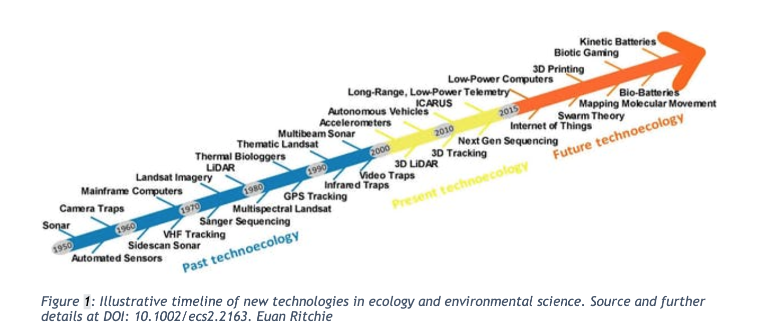
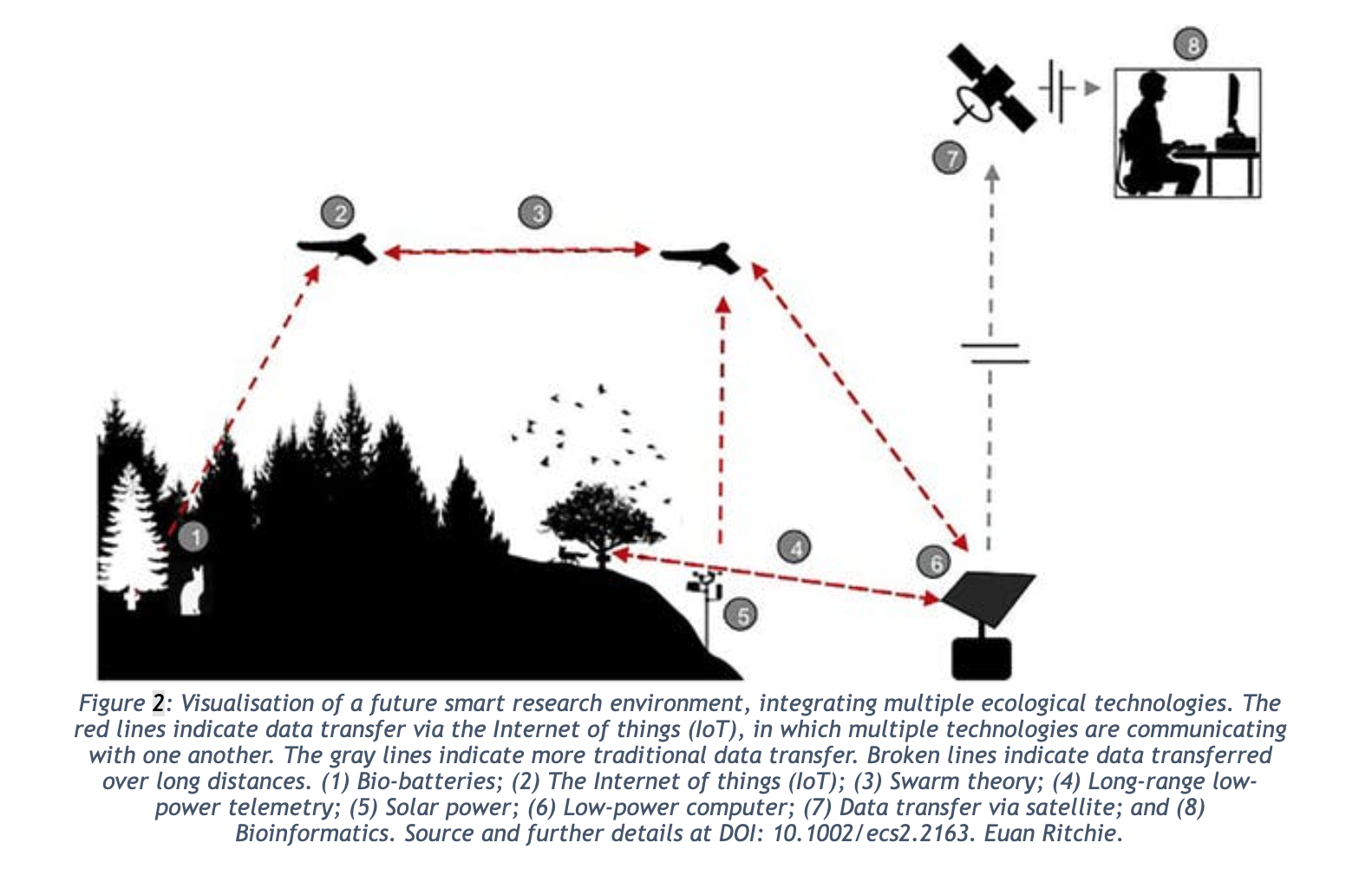
Top-down, satellite-based remote sensing technologies offer high-resolution mapping and visualization of species populations and their habitats, and the anthropogenic threats they face, such as deforestation and other landscape-level changes. The proliferation of satellites in space and the frequency with which they monitor data now provide conservationists with a near-real-time assessment of many wildlife population and landscape characteristics, and allow for an understanding of the movements (like migration) and behaviors of a large number of animals at one time, as opposed to putting collars on a few, for example. One California-based remote sensing company, Planet, has more than 150 satellites in orbit and the capacity to image any point on Earth at a 3 meter and 72 centimeter resolution. This type of imagery may partially or wholly obviate the need for costly field study of both wildlife populations and habitat, and may provide more accurate estimates with consistent standards of assessment. In another example, WWF has been using remote sensing technology with LIDAR (Light Detection and Ranging, a remote sensing technique that uses light to measure distances to earth) in order to assess forests and terrain in 3D. These technologies make things like whale watching now possible from space.
Satellite technology is also being combined with GPS-enabled bottom-up monitoring. For example, a satellite antenna named ICARUS (International Cooperation for Animal Research Using Space) has been attached to the International Space Station in order to capture the global migration movements of animals using GPS through solar-powered animal tags. The antenna is able to collect data on species such as altitude, temperature and speed and can provide up to 12 readings per day. Data collection from the tags began in 2019. (https://www.edf.org/blog/2018/07/13/satellite-antennas-other-tech-are-about-transform-conservation-we-know-it)
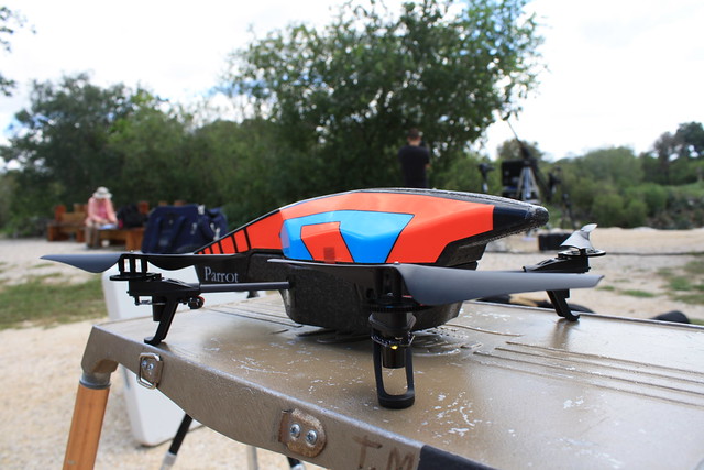
Remote control photography and video offers scientists the opportunity capture elusive animals and their behavior without the time and expense of in-person field monitoring. Imaging is possible over long periods of time for stationary cameras, such as camera traps (cameras that are triggered by motion), and allow for a more detailed study of particular species, or scientists can fly remotely controlled unmanned aerial drones to capture high resolution imaging of large areas of habitat that would require days of labor if done by individuals. Drones may contribute positively to wildlife conservation as noted in this National Geographic article. One such innovative drone is the remote-control “beetlecoptor”. The bettlecam has photographed lions at incredible close distances.
A team working in Sumatra has developed a $2,000 conservation drone with cameras, sensors and GPS to count orangutans and other endangered species and map deforestation on the island. The device can provide both real-time monitoring and longer-term data and information on species health and habitat.
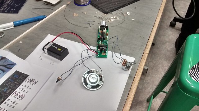
GPS-enabled collars track an animal’s real-time movement but also its hunting and feeding behaviors, and some are camera-enabled to provide real-time imagery in addition to movement data. Other tracking devices include solar-powered harnesses for small species such as birds:
This information enables scientists to quickly assess an animal’s current location in real-time, and over a period of time to better understand an animal’s territorial and other needs, and to better locate potential areas of human-wildlife conflict. GPS collars can be combined with other satellite data and imagery to build a more complete picture of a species’ status and threats to its habitat. Interesting examples of the use of high tech collars in California are provided here and here. International examples are provided in the video gallery below. Smart collars are also being used to identify areas of potential human-wildlife conflict, as in Kenya. In this example, the collars are equipped with SIM cards that can send a text message to smartphones on the location of the animals. These messages could potentially be used to alert individuals with assets in the path of the animals ahead of time.
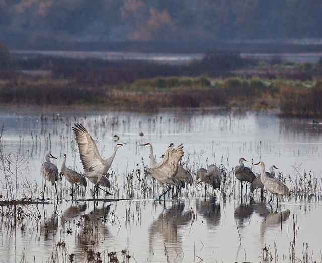
Acoustic monitoring of species is another method through which to capture species presence, movement, and behavior without requiring lengthy and costly field visits to remote areas. Technology has been used to record bird songs to assess climate impacts; to protect elephants from poaching, and to track endangered species.
Remote measurement of animals also holds promise for better data from species that are difficult to encounter, such as sharks, a species for which scientists are now employing a stereo-camera system that can take measurements without requiring human contact. The Zoological Society of London is also using a remote controlled helicopter to takes samples from the blow-holes of whales.
With the proliferation of handheld mobile devices, crowdsourcing conservation as become a viable method for tracking and protecting wildlife populations. For example, the Zoological Society of London’s Instant Wild app sends live video and images from motion cameras (camera traps) in wildlife areas to the smart devices of users, allowing anyone to become a wildlife conservationist. This type of technology can also assist those more directly involved in wildlife protection and conservation, such as park rangers, to quickly understand threats to wildlife under their care in real-time, and to respond. Another collaborative crowdsourcing for conservation effort among a number of international NGOs is the Freshwater Fish Bio Blitz initiative to collect data and information on the distribution and occurrence of freshwater species from citizen scientists. Other examples of crowdsourcing/citizen science apps include WildMe, iNaturalist; and Snapshot Serengeti.
Gene sequencing and assisted breeding are two areas experiencing advances in technology that will assist scientists in preserving captive wildlife populations. For example, scientists are currently employing gene-sequencing machines to isolate individuals in a species who are unaffected by disease for breeding. Assisted reproduction, as in this example of test tube conservation, is also experiencing technological advances. Scientists are also exploring IVF and stem cell technology to save species such as the white rhino.