Wildlife monitoring in remote and mountaintop forests in Wadi Wurayah, U.A.E
Challenges:
Wadi Wurayah in Fujairah, U.A.E., is a National Park with a variety of unique and delicate ecosystems that swell with biodiversity such as plants, mammals, fish, and birds. Wadi Wurayah is one of the few areas in the UAE that is bursting with intact freshwater resources. However, Wadi Wurayah is facing threats to its rich biodiversity and is dependent on the ongoing conservation efforts by the government of Fujairah, as well as local and international environmental organisations. The area of 129 square kilometres was declared the UAE’s first Mountain Protected Area in 2009.
A critical component of successful conservation efforts is the ability to monitor wildlife and other features inside large areas, such as national parks. Till recently, however, such important information can take a long time and be expensive to collect. Camera traps placed by conservationists and rangers take automatic photos of animals, triggered by motion. However, reaching the camera traps is dangerous and costly and it is time-consuming to upload the photos, costing at least Dh1 million a year to capture this data. High temperatures in summer pose dangerous hiking conditions and helicopters are expensive to reach these remote park areas.
Solution:
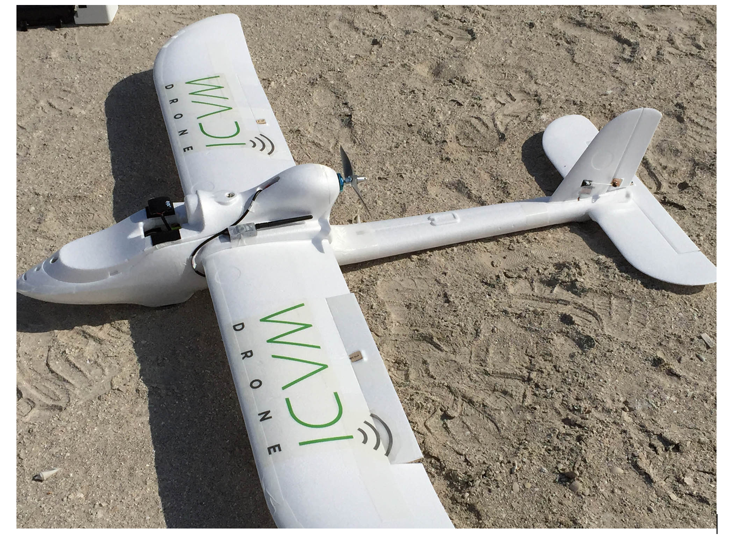
To combat these challenges, a team from New York University in Abu Dhabi has developed a 2.2kg drone that can fly for 1.5 hours for up to 40 km, collecting different types of data including images, salinity and atmospheric data in the mountainous Wadi Wurayah National Park. The drone flies over mountains and through valleys to wirelessly download photographs taken by ground-based camera traps that automatically capture images of wildlife as they pass in front of the camera’s motion sensor. The Wadi Drone serves the conservation efforts of the Emirates Wildlife Society by both increasing the rate at which photographic data of wildlife can be analyzed by experts, and by reducing the human risk associated with the current method of hiking to retrieve photos from remote camera traps.
Source: http://wadi.io
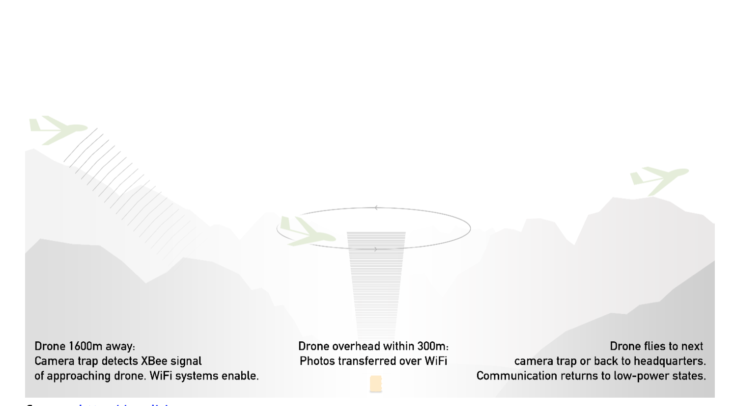
In the camera trap, the transmission system uses low-power XBee communications run on solar power, which turns on at regular 2 to 3 minute intervals to check whether the drone is approaching. The system also has a back-up transmission system via Wi-Fi in case of failure.
The drone hosts the same XBee and Wi-Fi systems and a microprocessor that is permanently turned on and powered by a litho-battery, which can be recharged from solar power once the drone returns to base. The drones are currently used to assess and evaluate the animal population, rather than climate change per se. However, new applications could include monitoring water quality and salinity in coastal regions and desalination of the Coast. (Harnessing the Internet of Things for Global Development, ITU)
The following video gives a snapshot of how the drone works: