Introduction
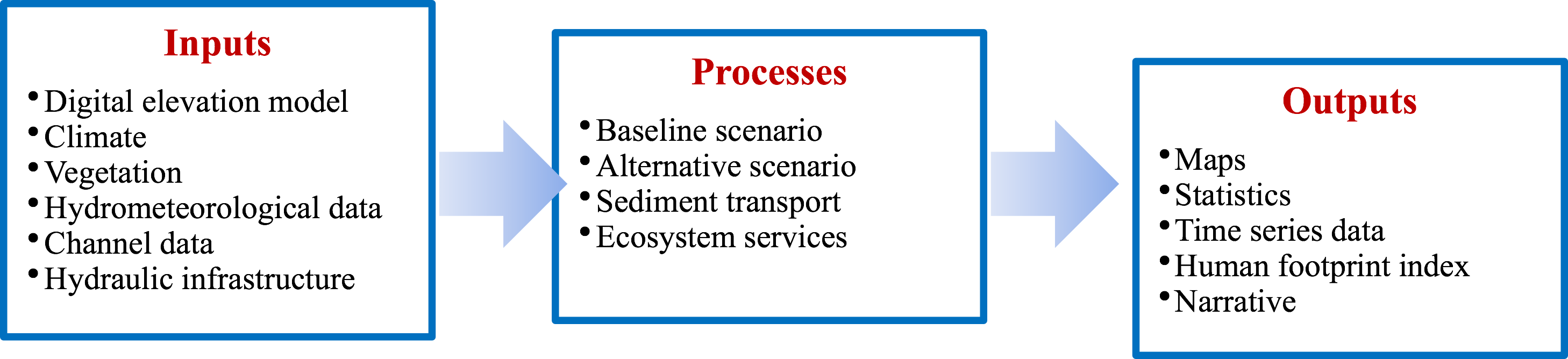
WaterWorld is a fully distributed physically based hydrologic, model that is utilized as a policy/ support
system especially in un-gauged and or data poor environments. The program incorporates a water quality model and
a sediment transport model. More specifically, the program computes a hydrological baseline and is then compared
to a potential scenario. Hydrologic computations use the water balance equation. WaterWorld can been applied to
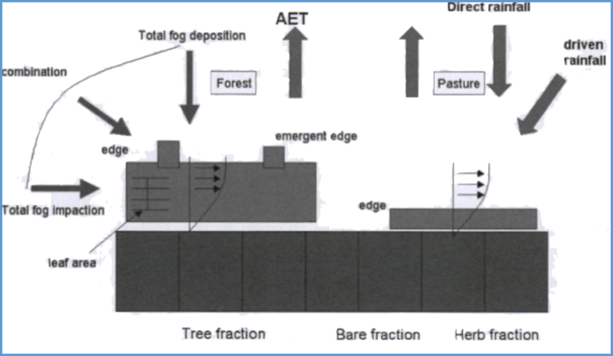
determine the hydrologic change from climate change, land use change, hillslope erosion, human impact on water
quality, land management decisions, and the impact of population and demography as well as any combination of
these as well as perform.
WaterWorld key features such as the ability to use cloud computing, freely available dataset when data is not
available, rapid learning time, process results within 1-hour and the ability to download the output data. The
program offers different level of functionality which is based on tiered based pricing.