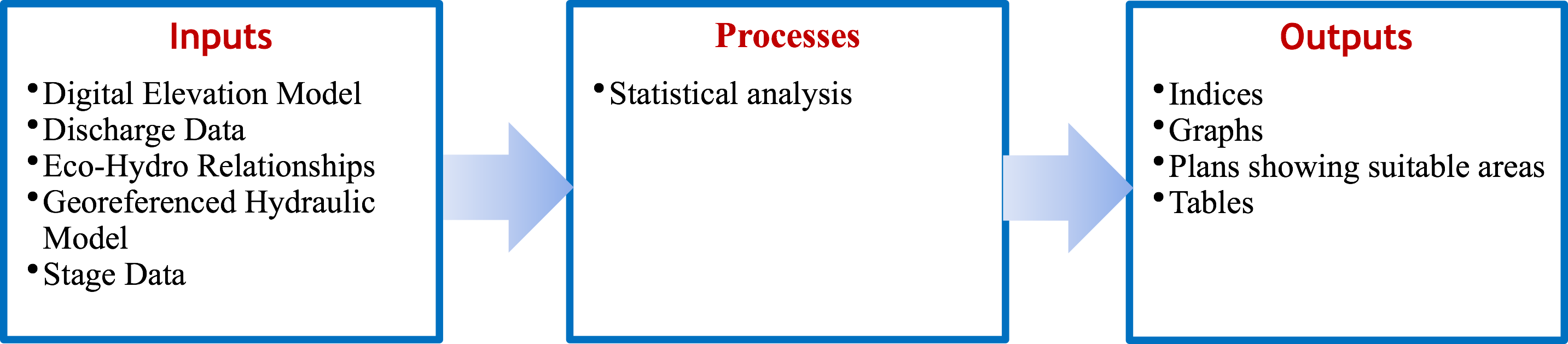
Introduction
The HEC-EFM (Ecosystem Function Model) is a planning tool for ecosystem restoration and water resource
management as it identifies ecological impacts (habitat and wetlands) resulting from a change in flow regime.
HEC-EFM analysis centers on functional relationships that relate hydrologic and hydraulic time series data with
the ecosystem using four basic criteria: 1) season, 2) duration, 3) rate of change and 4) percent exceedance.
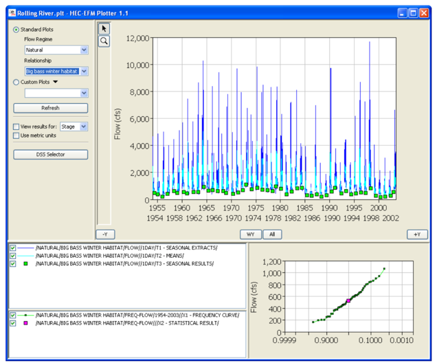
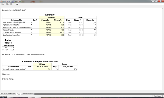
Using these functional relationships, HEC-EFM performs statistical computations on time series data of flow and
stage against specific criteria to produce a single flow value for each relationship. The program can be used to
determine the environmental effects of a change in reservoir operations.
Key features of the HEC-EFM model include reporting tools and GIS capabilities. The HEC-GeoEFM is an ArcMap
extension that supports spatial analyses frequently used when implementing the HEC-EFM. HEC-EFM also has
plotting tools that allow for multiple concurrent comparisons. Use of the HEC-GeoEFM requires a user license for
ArcMap, and for Spatial Analyst and 3D analyst extensions for ArcMap.