Introduction
Flood Modeller, formerly known as ISIS, is an integrated 1D and 2D hydrodynamic model that simulates flow and
water depth in rivers, estuaries, and urban areas. Flow direction (one-way or multi-directional) and rate
(gradual rise and fall as in a flood, or rapid flow variation as in a dam breach) informs the use of 1D and/or
2D modeling. 1D modeling uses the Saint Venant equation for hydrodynamic modeling while 2D models employ the
shallow wave equation Flood Modeller applications include estimating water surface elevation in a river,
designing hydraulic structures, dam breach analysis, sediment transport, and water quality analysis.
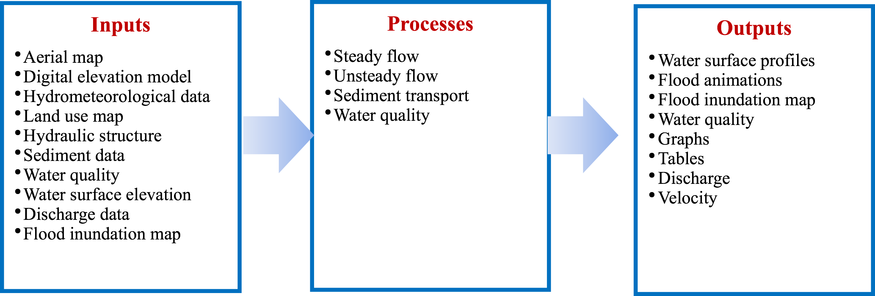
Key features of the Flood Modeller includes Graphical User Interface (GUI), a 2D solver that performs
calculations up to 1,000 times faster than a traditional solver, the ability to compute a hydrograph that can
then be entered into the model, and a mapping program that can import geospatial data and visualize results. The
'Free' and 'perpetual license ' models differ in their functional abilities.