Introduction
HEC-RAS, first released in 1995 as the successor to HEC-2, models 1D hydraulic processes for a full network of
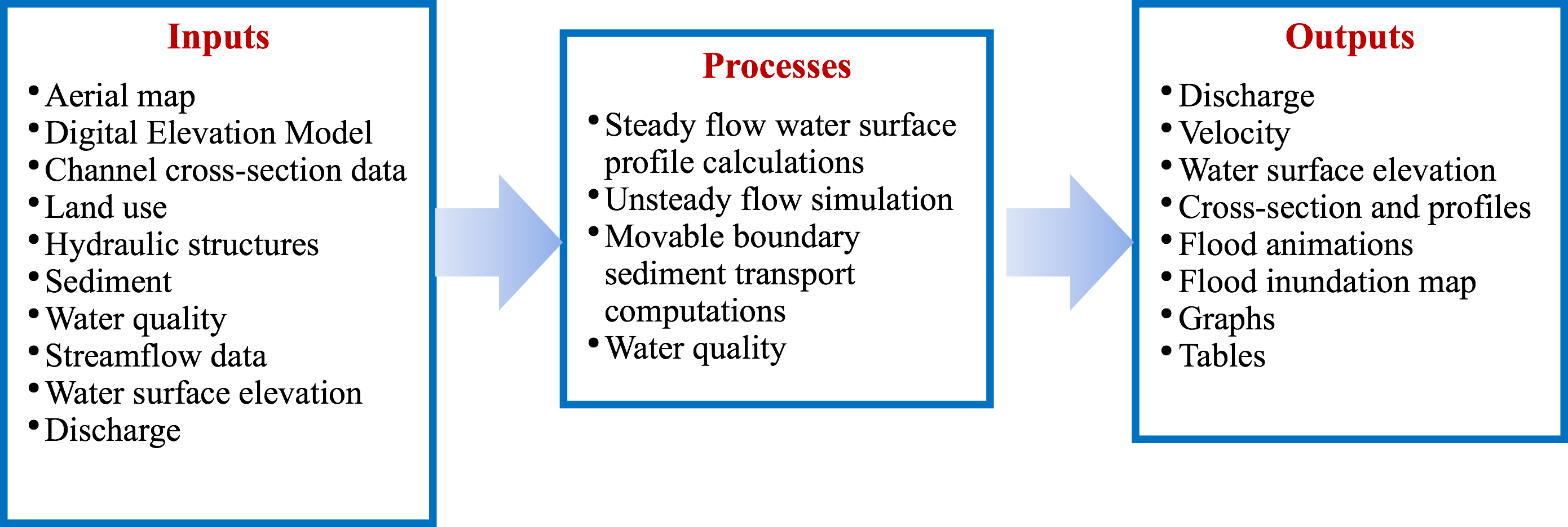
natural and constructed channels. HEC-RAS contains 4 1D hydraulic components that model steady water flow,
unsteady water flow surface profiles, movable boundary sediment transport, and water quality. HEC-RAS models
steady flow using the energy equation and the standard step method, and unsteady flow using the Saint Venant
equation. HEC-RAS has been used to design hydraulic structures, for bridge scour analysis, floodplain analysis,
dam break and levee breach analysis, sediment transportation, evaluation of deposition in reservoirs, and water
quality. Although applications are of multidimensional nature, the software's solutions involve one-dimensional
calculations. Key features of the HEC-RAS model include a Graphical User Interface (GUI), data storage and
management, and GIS-related tools and capabilities.