LISFLOOD

Purpose: Model river discharge within a river basin
Developer: European Commission Joint Research Centre (JRC)
Key Features: GIS-based distributed model; Python based interface
Latest Release: 2014
OS Platform: Linux, Windows
Cost: Free
Related Software: CREST, HEC-HMS, SAC-SMA, MIKE-SHE
Website: LISFLOOD

Introduction

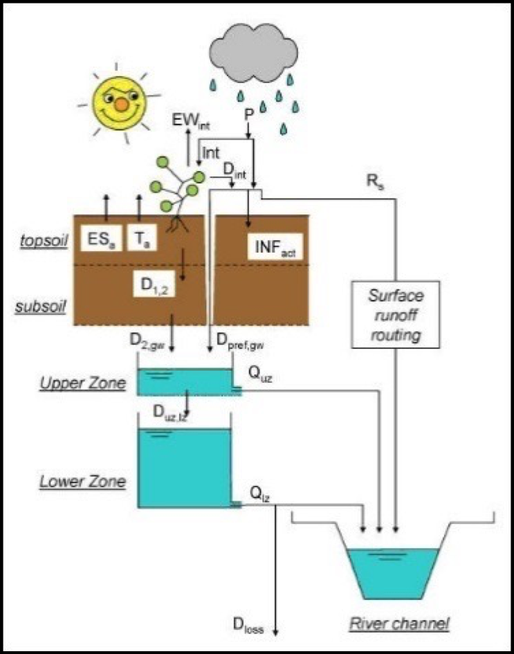
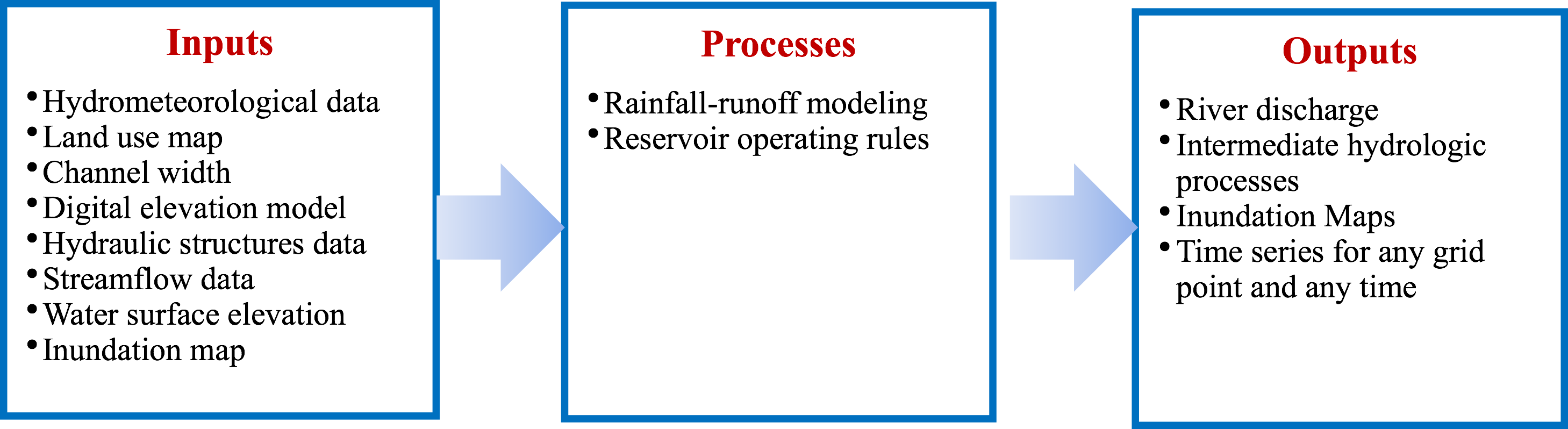
LISFLOOD, first developed in 2000, is a is a physically-based distributed hydrologic model that simulates long-term catchment water balance as well as individual flood events. LISFLOOD is usable for a wide variety of applications, for example, flood forecasting, water resources forecasting and climate change assessment studies. The model can also be used to assess the effects of river regulation measures and for studies incorporating trans-boundary catchments. LISFLOOD has been applied to medium and large basins as well as on a continental scale.

Key features of the LISFLOOD model include flood forecasting at a basin scale, the incorporation of remote sensing data such as radar data or altimetry data, and simulation of wetlands and lakes. PCRaster is a raster-based GIS environment used to process geospatial data for the model.

Advantages and Limitations

Advantages Limitations
  • Can be coupled with global raster databases, including weather forecasting
  • Allows output discharge values as well as all internal state variables at user defined grid locations as either maps or time series
  • Detailed technical report and users' manual
  • Ability to run on a Linux cluster
  • Program works for a medium or large basin
  • Limited by 2000 X 2000 cells for public release version
  • Requires high resolution and accurate topography
  • DOS command prompt is used to run the program
  • Flow within the channel is 1D and assumes kinematic wave equation
  • Channel is assumed to be wide and shallow
  • Cannot be used for dam breach analysis

Illustrative Screens

Sample Applications

Africa East Asia and the Pacific Europe & Central Asia Latin America & the Caribbean Middle East and North Africa South Asia
Ensemble flood forecasting in Juba-Shabelle River Basin

World Bank - All rights reserved.