IDRISI Earth Trends
| Name/Title: | TerrSet |
| Source | Clark Labs |
| Category | Visualization and Analysis Software |
| Sector | CT, Forestry, Disaster, Water Resources, Biodiversity |
| Technology Platform | Software |
| Date Started/Timeframe | 1987 - present |
| Website/URL | https://clarklabs.org/about/ |
| Location(s) | Worcester, MA |
| Primary Language(s) | English |
| Keywords | Data Visualization, Modeling, Remote Sensing |
| Targeted Stakeholder | Crowdsourcing communities, data collectors, data management officers |
Screenshot of website:
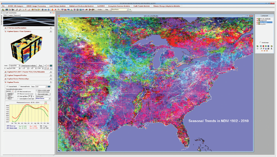
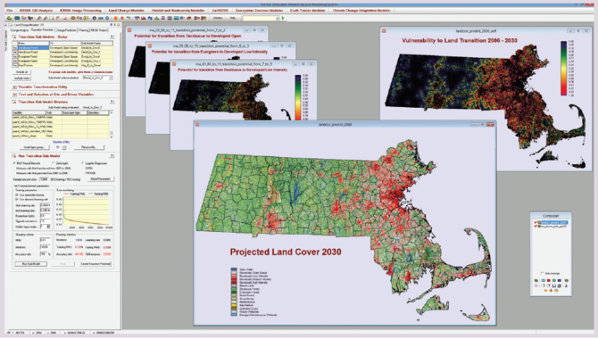
Description: Since 1987, Clark Labs has been actively developing IDRISI GIS and Image Processing software. In 2015, they released TerrSet software, which includes IDRISI software tools, along with an additional constellation of software tools for modeling the earth system. These include the Land Change Modeler, Earth Trends Modeler, GeOSIRIS, Ecosystems Services Modeler, Habitat and Biodiversity Modeler and Climate Change Adaptation Modeler. The suite includes over 300 analytical tools, primarily oriented to raster data, for the manipulation of geospatial datasets and an extensive set of procedures for image restoration, enhancement, transformation and classification of remotely sensed imagery. Sub-modules act as innovative land planning and decision support software tool for land change analysis and prediction with a special facility for REDD project-level modeling, tools for habitat assessment, landscape pattern analysis and biodiversity modeling, mapping impacts of national-level REDD projects on deforestation, carbon emissions, agricultural revenue and carbon payments.
How can the ICT product/innovation benefit the project?
The core features of TerrSet modeling tools are the same set of features much needed by forestry sector decision making process involving land use planning, better biodiversity and habitat knowledge, assessment of emissions and devising carbon payments.