Measuring Precipitation: On the Ground and from Space

Today, scientists can measure precipitation directly—using ground-based instruments such as rain gauges—or indirectly—using remote sensing techniques (e.g., from radar systems, aircraft, and Earth-observing satellites).

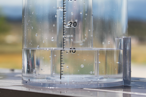
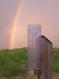
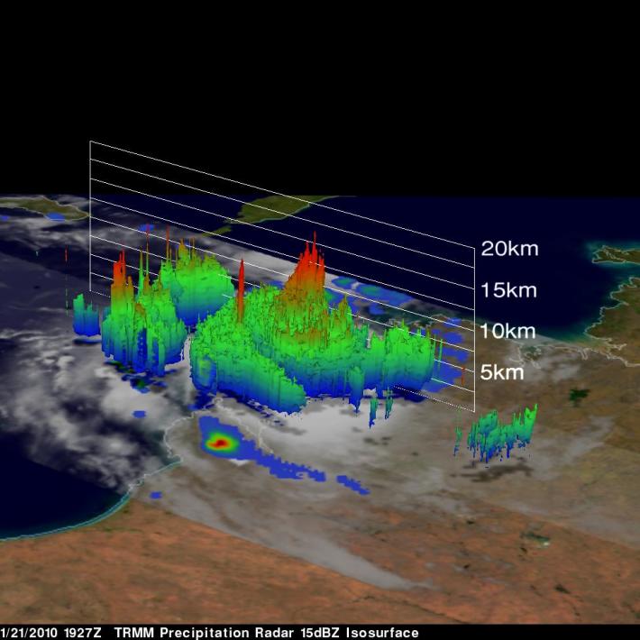
Rain gauges measure precipitation amounts at a given location. Oftentimes measurements from an individual rain gauge are used to represent precipitation conditions across larger areas, i.e., between gauge sites. However, that isn’t always the best assumption. The reality is that precipitation may fall more- or less-intensely at the location of the gauge—or it may miss the gauge entirely. Damage or obstructions to a gauge or the presence of strong winds can also introduce error.


Image credit: CoCoRaHS


Ground-based weather radars emerged during World War II and have since been used to observe precipitation, mostly over land. Ground-based radars send out pulses of microwave energy in narrow beams that scan in a circular pattern. When the microwave pulse encounters precipitation particles in the atmosphere, the energy is scattered in all directions, sending some energy back to the radar. These measurements are used to estimate intensity, altitude, precipitation type (e.g., rain, snow, hail), and motion. Obtaining continuous measurements of precipitation from ground-based systems (e.g., from rain gauges and radar systems) presents a challenge due to large gaps between monitoring sites on land and huge gaps over the ocean.


Set up on a ranch in Rutherford County, N.C., NASA's Dual-frequency, Dual-polarization, Doppler Radar (D3R) is one of several ground radars measuring rain as it falls from clouds. It has the same two frequencies as are on the GPM Core Observatory Satellite. Photo credit: David Wolff

Earth-observing satellites can provide frequent estimates of precipitation at a global scale. To do this, satellites carry instruments designed to observe specific atmospheric characteristics such as cloud temperatures and precipitation particles, or hydrometeors. These data are extremely useful for filling in data gaps that exist between rain gauge and ground-based radar sites and offer insights into when, where, and how much precipitation is falling worldwide. Satellite data also provide a unique vantage point. While ground-based instruments can directly measure or estimate how much precipitation falls to the ground, satellite instruments estimate the amount of electromagnetic radiation (or energy) that is emitted or reflected either from the tops of the clouds or from the rain droplets themselves, providing a top-down view. Spaceborne radar instruments can even observe the three-dimensional structure of precipitation. Such satellite observations are detailed enough to allow scientists to distinguish between rain, snow, and other precipitation types, as well as observe the structure, intensity, and dynamics of storms.


The Tropical Rainfall Measurement Mission (TRMM), a joint mission between NASA and the Japan Aerospace Exploration Agency (JAXA), was launched in 1997. TRMM measured heavy to moderate rainfall over tropical and subtropical regions for over 17 years, until the mission ended in April 2015. Measurements from TRMM advanced our understanding of tropical rainfall, particularly over the ocean, and provided three-dimensional images of storm intensity and structure from space using the first satellite-borne weather radar.


Image showing TRMM's Precipitation Radar (PR) and the TRMM Microwave Imager (TMI) instrument resolving the intensifying thunderstorms near a tropical cyclone Magda’s eyewall off the northwest coast of Australia on January 21st, 2010.

TRMM’s successor is another joint NASA-JAXA mission called the Global Precipitation Measurement (GPM) Core Observatory, launched on February 28, 2014 from the Tanegashima Space Center, in Japan. The Core Observatory carries two instruments—the Dual-frequency Precipitation Radar (DPR) and GPM Microwave Imager (GMI)—collecting observations that allow scientists to dissect storms. Like a diagnostic CAT scan, the DPR provides a three-dimensional profile that shows the intensities of liquid and solid precipitation. The GMI provides a two-dimensional view to look in depth at light rain to heavy rain and falling snow—like an X-ray. The Core Observatory is part of an international constellation of domestic and international satellites that together provide global observations of precipitation from space—called the GPM mission. Together, the constellation observes rain, snow, and other precipitation data worldwide every three hours.


Play