One of the most exciting areas of modernization in relation to data has been in terms of new ways to integrate and visualize the data on spatial platforms. Being able to visualize, manipulate and analyze spatial data is paramount to watershed management, given that many, if not all, aspects of basin management – climate, water resources, water use, landuse, etc. - depend on spatial relationships. There are a number of popular software that have been developed for undertaking GIS, remote sensing or other spatial analysis. Spatial tools for forestry management are included in commercial or open source Geographic Information System (GIS). Commercial GIS software has license restrictions, does not publish the underlying code and charges a licensing fee, but is often better streamlined. Open source GIS software publishes the underlying code, has less restriction on licensing and is free to use for commercial purposes, but is often less streamlined. An illustrative (but non-exhaustive) list of some popular open source and commercial software that can support forest management (e.g. spatial analysis, visualization, integration of GPS and other field data, etc.) include:
- Google Earth is a very popular way to get free 3-D high-resolution spatial perspectives on any watershed around the earth. It can now be accessed directly in a Chrome browser at http://earth.google.com or downloaded as a desktop version Google Earth Pro at the same site. It allows easy visualization of high-resolution satellite imagery timeseries draped over a 3-D model of the earth and also allows integration of GIS, animations, photos, videos, 3-D models, or other objects into the visual experience, along with fly-throughs of watersheds that can be shared as links or video files.
- Quantum (QGIS) GIS is a free open source program licensed under GNU Public license, QGIS is user friendly and provides a lot of documentation for beginners, it is also one if not the most widely used open source GIS software. QGIS is regularly updated and the code is maintained by a large group of developers. Furthermore, other programs on the list can be added to the QGIS toolset. QGIS can read most vector and raster file formats as well as all the common geodatabase and web map services. QGIS composer can produce maps from various layers.
- System for Automated Geoscientific Analyses (SAGA) GIS is a free open source program licensed under GNU Public license. SAGA GIS is a spatial modeling GIS program for intermediate to advanced users in spatial modeling. Users should note that SAGA GIS could be used as part of QGIS or R. SAGA GIS’s strength is in spatial statistics analysis, namely spatial sampling, interpolation and modeling. All SAGA tools can be used to predict forest fire as well as forest health risk indicators.
- Geographic Resources Analysis Support System (GRASS) GIS is a free open source program licensed under GNU Public license. GRASS GIS is for advanced users, preferably with experience in GIS and image processing. GRASS GIS is best used for raster analysis. GRASS computes various raster analyses such as Leaf Area Index (LAI), Normalized Difference Vegetation Index (NDVI) or forest fragmentation analysis.
- R + spatial packages (sp, rgrass7, raster, rgdal, spdep, rgeos) is a free open source program licensed under GNU Public license. R is a statistical scripting environment and includes many geo statistical analysis packages. R has a steep learning curve and is for advanced users with experience in GIS, spatial data analysis and python or another language. Albeit extremely versatile, R strength lies in script automation and statistical analysis. Shiny provides web-based support for R.
- IDRISI is a popular image processing software with a suite of associated tools primarily for raster data analysis.
- Environmental Systems Research Institute (ESRI) is an industry leader for commercial GIS systems (e.g. ArcGIS), used in over 350,000 organizations around the world. They also have free online GIS viewers. There are also a number of growing applications in forestry.
- Intergraph and Hexagon have a range of commercial geospatial software (e.g. ERDAS IMAGINE, GEOMEDIA) that are popular for remote sensing and GIS use.
- Harris has a number of products such as ENVI that are very popular for remote sensing analysis.
- Explore here to get more of a flavor for the large number of firms and open-sources and commercial spatial analytical products that could be useful in watershed management.
Looking ahead, there are a few new types of technologies that show immense promise for revolutionizing watershed analysis:
- Systems integration of existing software to create powerful new tools. For example, Collect Earth is a tool that combines the power for Google Earth, Bing Maps, and Google Earth Engine to facilitate data collection (E.g. to support multi-phase National Forest Inventories) – the data is also exportable to Saiku to facilitate data analysis.
- Machine Learning is a rapidly-evolving artificial intelligence discipline that helps systems to learn without being explicitly programmed – i.e., which can adapt the programs when exposed to new data.
- Virtual Reality or Augmented Reality may look like science-fiction now, but at the rate at which these technologies are being deployed, it will be relatively soon when one can visualize and interact with watershed development and climate scenarios in a completely different way than we currently do.
- Google Earth Engine is a radically new approach to spatial analysis, combining a growing catalog of free, public-domain satellite imagery and geospatial datasets with cloud computing and collaborative platforms. Some Google Earth Engine applications that are particularly interesting from a watershed perspective include:
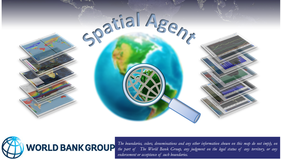
- Spatial Agent
is an
innovative mobile App from the World Bank that seeks to showcase a growing set of
public-domain data from thousands of online mapping and data services. New versions include cloud
analytics
(e.g. computation of NDVI from MODIS or Landsat or CHIRPS rainfall data analysis) using the Google
Earth
Engine
API. This helps bring a world of information and analytics at one’s fingertips when exploring or
analyzing
watersheds around the world.
-
There are also ways of developing ways of packaging interactive maps into e-Atlases. Some examples
of these
being prototyped by the World Bank include:
- World Bank Global Reach Spatial Agent Global Portal for
Water:
http://www.appsolutelydigital.com/GlobalReach/map.html - Sudan: http://www.appsolutelydigital.com/Sudan/index.html
- Indonesia: http://www.appsolutelydigital.com/Indonesia/index.html
- Western Balkans: http://appsolutelydigital.com/WestBalkans/cover.html
- Central Asia: http://www.appsolutelydigital.com/CentralAsia/cover.html
- Africa Regional: http://www.appsolutelydigital.com/AfricaAtlas/cover.html
- Senegal: http://www.appsolutelydigital.com/Senegal/cover.html
- Nepal: http://www.appsolutelydigital.com/Nepal/cover.html
- World Bank Global Reach Spatial Agent Global Portal for
Water: