Forests
Overview
The primary landcover in the Congo basin is forest.
Congo forests are critical to the livelihoods of the 75 million people of the basin.
Within the Congo Basin, approximately 200 million hectares is covered by forest. The Congo Forest consist of tropical forest, a dryland forest, a patchwork of forest and savannahs, and savannah with isolated trees.
Indigenous groups rely on their forest, but it varies from group to group. Pygmies are a nomadic group that lives as hunters and gatherers that use the forest for food, water, shelter, income and medicine. Another indigenous group, the Bantus, live on the outskirt as farmers but uses the forest for additional income.
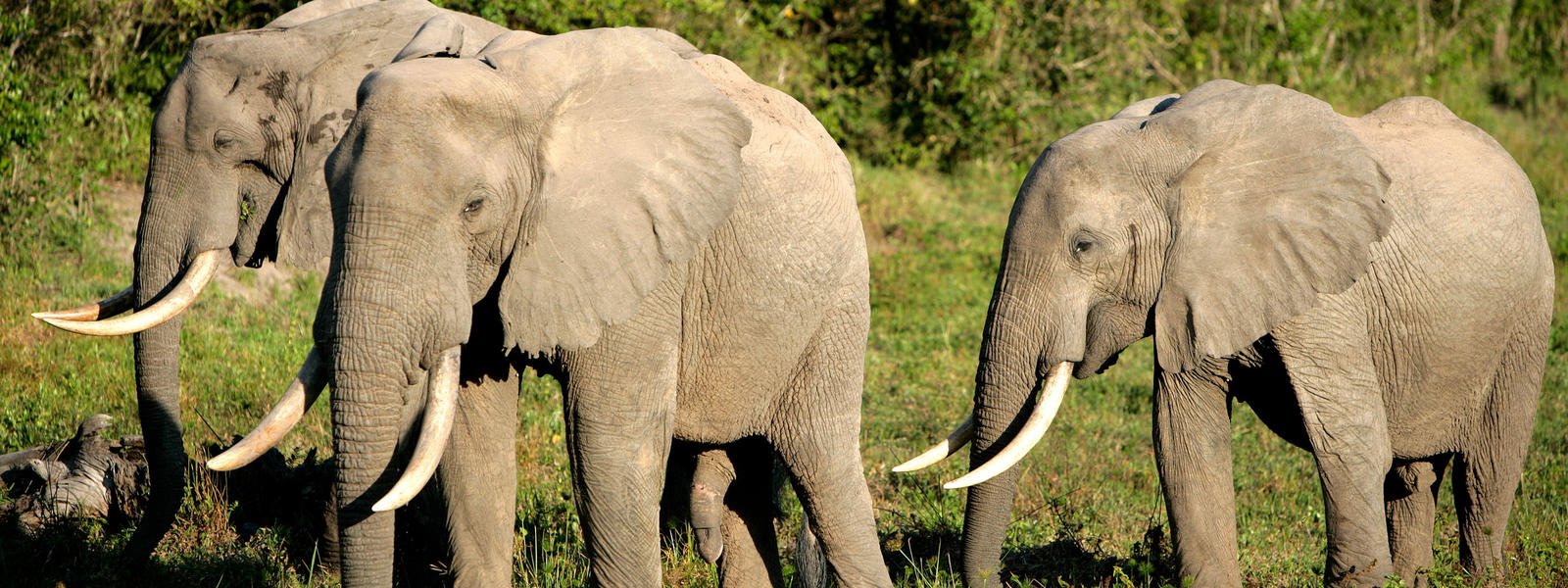
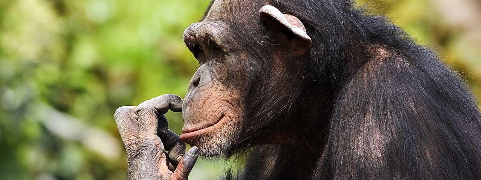
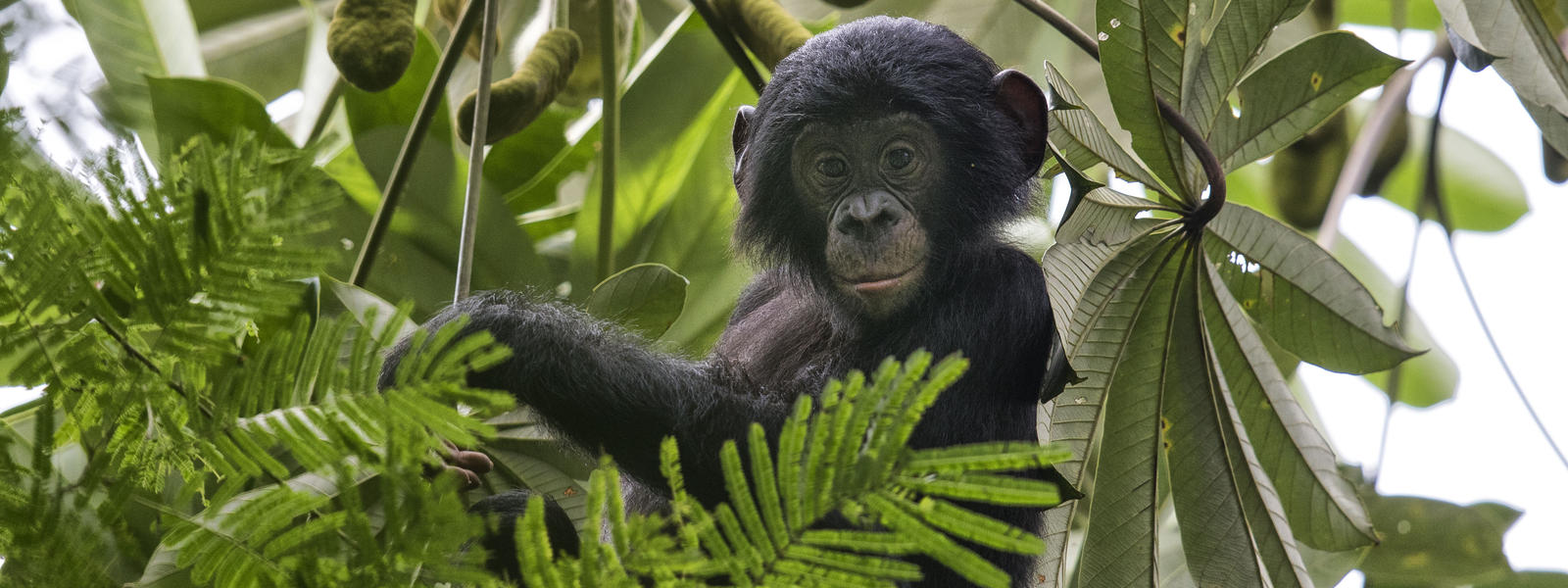
Congo basin has an abundance of fauna and flora. Approximately 1/5 of every species on the planet is in the basin that include gorillas, elephants, buffalos, chimpanzees, 400 species of mammals, 1000 species of birds, 700 species of fish. There are 10,000 different species of flora where 30% is specific to the region (source: WWF). The Afrormosia tree, which is required for a healthy ecosystem since the tree provides shade, shelter and food for underplants, butterflies and beetles respectively along with a fire- resistant bark that allows it to be a pioneer after a fire event. Afrormosia is also in high demand via consumers because of its durability and resistance to insects.

Wetland in the Congo Basin regulate flow to prevent flooding, provides water quality, and affects regional climate. Congo and DRC share the largest transboundary RAMSAR wetland called “Complexe Transfrontalier Lac Télé - Grands Affluents - Lac Tumba” which has an approximate area of 129,000 km2. The Cuvette Central peatland, an area of 145,000 km2 is the largest tropical peatland in the world. It is estimated that the carbon emission from the peatland is equivalent to 20-years of fossil fuel emissions from the US. Peatland are susceptible to climate change if a drying out period occurs. This will cause carbon to be released back into the environment.
Congo Basin provides multiple ecosystem services. On a global scale, it provides carbon sequestration, and regulates local, regional and global precipitation patterns. Within the basin it’s a water supply, timber, fuel, reduce sedimentation downstream which affects dam turbines, controls flow and provides water quality, fisheries wildlife habitat and is a tourism attraction due to the abundance of wildlife.
An economic value of ecosystem service account for direct goods such as timer, fuel, medicines, recreation, indirect values from watershed restoration, values for future usage and cultural, social heritage. Although it is not feasible to account for all goods and services since links and values change over time and space. An estimate of the overall goods and service is approximately 11 billion per year, but it is expected to be much higher.
Looking Ahead
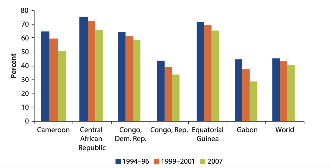
The Congo basin is facing severe threats of deforestation. Some experts predict that the forests would disappear by 2100 in a business as usual scenario. The map below shows the deforestation that has taken place since 2000 (Hansen).
Annual deforestation rate is stable at 250,000-300,00 ha, which works out to 0.15-0.2 percent per year. The leading causes of deforestation are caused by the local population via small scale subsistence agriculture via slash and burn, and collection of fuel wood. Other deforestation projects on a smaller scale are industrial projects, selective logging, residential and commercial construction large scale Agro-Industrial projects, selective logging, development of commercial and residential buildings, mining, fires, and natural erosion. The warming temperature is drying out the forest and is changing the forest type.
The drivers of deforestation are complex. For example, some researchers have indicated that deforestation could be enhanced when the population density has reached 8 people/km2 and the percentage of landcover to total areas has reached 20%. The population in economic activity is over 60% for over half the countries, while the expenditure to improve agriculture is on average 2%. This has not allowed any efficiencies to be made in agriculture production.
The energy sector relies on wood-based products. Urban areas ten to have a more energy intensive lifestyle use charcoal over wood products, because its more economical to transport and store. In Kinshasa, 8-10 million people require 5 million cubic meters of wood fuel a year. Some expect population growth, and increased urbanization will cause charcoal to grow in the future without other affordable alternatives.
Introduction of roads in the DRC tend to cause 2-3 time more deforestation then at another location. Once a road is introduced for industrial logging it allows other usages. Farmers now have access to the forest to perform small scale slash and burn agriculture, poaching, and allows migration into the forested area.
Management
The countries of the Congo basin have also protected some of the areas as shown in the interactive map below (World Database of Protected areas from WRI ResourceWatch). Monitoring of fires is performed using the MODIS Satellite. MODIS being an optical sensor that cannot see through cloud cover may miss a lot of fires. Although the location of fire is available at a global level, the lack of internet connectivity, institutional capacity, and inefficient measures to transmit the data prevents adoption of the technology. Fire monitoring is also hampered by lack of fire management plans and land tenure ownership. Poaching has been tested with the use of community involvement and smartphone technology.